
Mount Becher topographic map
Click on the map to display elevation.
About this map
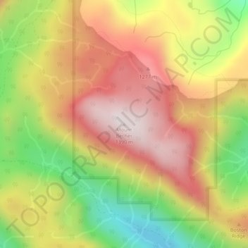
Name: Mount Becher topographic map, elevation, terrain.
Average elevation: 3,396 ft
Minimum elevation: 2,041 ft
Maximum elevation: 4,524 ft
Other topographic maps
Click on a map to view its topography, its elevation and its terrain.
Croteau Lake
Canada > British Columbia > Comox Valley Regional District > Area C (Puntledge/Black Creek)
Average elevation: 3,921 ft
Oyster River
Canada > British Columbia > Comox Valley Regional District > Area C (Puntledge/Black Creek)
Average elevation: 3,097 ft
Oyster River
Canada > British Columbia > Comox Valley Regional District > Area C (Puntledge/Black Creek)
Average elevation: 3,192 ft