
Make a donation
Gear up for your next adventure:
As an Amazon Associate, this site earns from qualifying purchases at no extra cost to you.
Montague topographic map
Click on the map to display elevation.
Make a donation
Gear up for your next adventure:
As an Amazon Associate, this site earns from qualifying purchases at no extra cost to you.
About this map
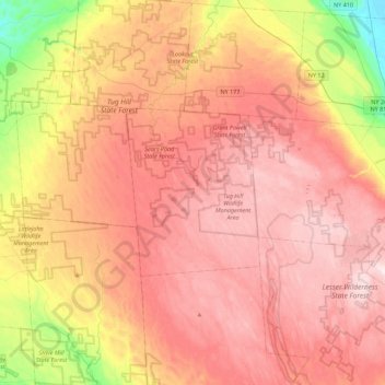
Name: Montague topographic map, elevation, terrain.
Location: Montague, Lewis County, New York, United States (43.55785 -75.86980 43.87785 -75.54980)
Average elevation: 1,542 ft
Minimum elevation: 715 ft
Maximum elevation: 2,096 ft
Lewis County trails, hiking, mountain biking, running and outdoor activities
Make a donation
Gear up for your next adventure:
As an Amazon Associate, this site earns from qualifying purchases at no extra cost to you.
Other topographic maps
Click on a map to view its topography, its elevation and its terrain.
Town of Lowville
United States > New York > Lewis County
Lowville /ˈlaʊvɪl/ is a town in Lewis County, New York, United States. The population was 4,888 at the 2020 census, down from 4,982 in 2010. The town is near the center of the county and is southeast of the city of Watertown. The town of Lowville contains a village also named Lowville, which is the county…
Average elevation: 948 ft
Beartown State Forest
United States > New York > Lewis County > Town of Croghan
Average elevation: 879 ft
Make a donation
Gear up for your next adventure:
As an Amazon Associate, this site earns from qualifying purchases at no extra cost to you.
Beaver River
United States > New York > Lewis County > Town of Croghan > Village of Croghan
Average elevation: 840 ft
Make a donation
Gear up for your next adventure:
As an Amazon Associate, this site earns from qualifying purchases at no extra cost to you.
Boonville Forest Preserve Detached Parcel
United States > New York > Lewis County
Average elevation: 1,165 ft
Village of Castorland
United States > New York > Lewis County > Town of Denmark
Average elevation: 764 ft
Make a donation
Gear up for your next adventure:
As an Amazon Associate, this site earns from qualifying purchases at no extra cost to you.
Town of West Turin
United States > New York > Lewis County
West Turin has a warm-summer humid continental climate (Dfb). Winter is cold and very snowy, with most days not making it to freezing. Snow can fall anytime from October to May, and a consistent snowpack is expected from November to April. Due to its elevation, it is one of the coldest, snowiest, and wettest…
Average elevation: 1,644 ft