
Beaverdell topographic map
Click on the map to display elevation.
About this map
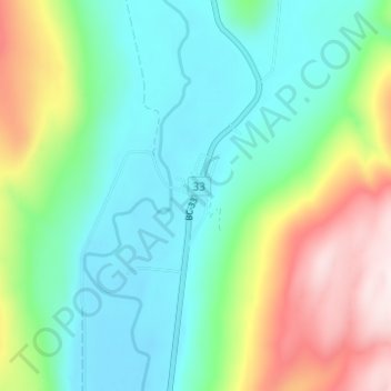
Name: Beaverdell topographic map, elevation, terrain.
Average elevation: 3,136 ft
Minimum elevation: 2,516 ft
Maximum elevation: 4,570 ft
Other topographic maps
Click on a map to view its topography, its elevation and its terrain.
Idabel Lake
Canada > British Columbia > Regional District of Kootenay Boundary > Area E (Beaverdell/West Boundary)
Average elevation: 4,160 ft
Stump Lake
Canada > British Columbia > Regional District of Kootenay Boundary > Area E (Beaverdell/West Boundary)
Average elevation: 4,334 ft
Conkle Lake
Canada > British Columbia > Regional District of Kootenay Boundary > Area E (Beaverdell/West Boundary)
Average elevation: 4,006 ft
Boundary Creek Provincial Park
Canada > British Columbia > Regional District of Kootenay Boundary > Area E (Beaverdell/West Boundary)
Average elevation: 2,884 ft