Geolocate

Colorado Springs topographic map

Interactive map

Click on the map to display elevation.

About this map

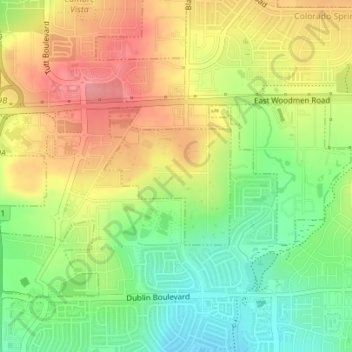
Name: Colorado Springs topographic map, elevation, terrain.

Location: Colorado Springs, El Paso County, Colorado, United States (38.92997 -104.70923 38.94060 -104.69667)

Average elevation: 6,880 ft

Minimum elevation: 6,729 ft

Maximum elevation: 7,031 ft

El Paso County trails, hiking, mountain biking, running and outdoor activities

Other topographic maps

Click on a map to view its topography, its elevation and its terrain.

Palmer Lake

United States > Colorado > El Paso County

The town marks the top of the Palmer Divide, a ridge running from Palmer Lake eastward which separates the Arkansas River drainage to the south from the Platte River drainage to the north. The highest point of the divide is about 7,700 feet (2,300 m) above sea level at Vollmer Hill located in the Black Forest.…

Average elevation: 7,552 ft

Peyton

United States > Colorado > El Paso County

Average elevation: 6,824 ft

Fountain

United States > Colorado > El Paso County

Average elevation: 5,656 ft

Colorado Springs

United States > Colorado > El Paso County

Snowfall is usually moderate and remains on the ground briefly because of direct sun, with the city receiving 38 inches (97 cm) per season, although the mountains to the west often receive in excess of triple that amount; March is the snowiest month in the region, both by total accumulation and number of days…

Average elevation: 7,313 ft

Falcon

United States > Colorado > El Paso County > Falcon

Average elevation: 6,926 ft

Gleneagle

United States > Colorado > El Paso County

Average elevation: 6,886 ft

Yoder

United States > Colorado > El Paso County

Average elevation: 6,178 ft

Woodmoor

United States > Colorado > El Paso County

Average elevation: 7,251 ft

Stratmoor

United States > Colorado > El Paso County

Average elevation: 5,840 ft

Wigwam

United States > Colorado > El Paso County

Average elevation: 5,266 ft

Security

United States > Colorado > El Paso County

Average elevation: 5,804 ft

Calhan

United States > Colorado > El Paso County

Average elevation: 6,549 ft

Stratmoor Hills

United States > Colorado > El Paso County

Average elevation: 5,902 ft

Cascade

United States > Colorado > El Paso County

Average elevation: 8,179 ft

Glen Park

United States > Colorado > El Paso County > Palmer Lake

Average elevation: 7,615 ft

Cimarron Hills

United States > Colorado > El Paso County

Average elevation: 6,394 ft

Rush

United States > Colorado > El Paso County

Average elevation: 6,020 ft

Rocky Mountain

United States > Colorado > El Paso County

Average elevation: 8,510 ft

Palmer Lake

United States > Colorado > El Paso County > Palmer Lake

Average elevation: 7,579 ft