Geolocate

Felton topographic map

Click on the map to display elevation.

About this map

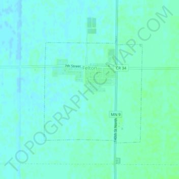
Name: Felton topographic map, elevation, terrain.

Location: Felton, Clay County, Minnesota, United States (47.06720 -96.51647 47.08335 -96.49470)

Average elevation: 915 ft

Minimum elevation: 906 ft

Maximum elevation: 928 ft

Clay County trails, hiking, mountain biking, running and outdoor activities

Other topographic maps

Click on a map to view its topography, its elevation and its terrain.

Baker

United States > Minnesota > Clay County

Average elevation: 938 ft

Hitterdahl WMA

United States > Minnesota > Clay County

Average elevation: 1,243 ft

Moorhead

United States > Minnesota > Clay County > Moorhead > Moorhead

Average elevation: 909 ft

Kragnes

United States > Minnesota > Clay County

Average elevation: 896 ft

Gear up for your next adventure:

☀️Outdoor Sunscreen - High protection sunscreen for outdoor activities
🧯Emergency Survival Kit - All‑in‑one survival essentials for the backcountry
🪶Multi‑Purpose Knife - Useful blade for camp and trail
🛡️Bear Spray Outdoor - Protection in bear country hikes
🥩Freeze-Dried Meals - Nutritious and lightweight food for remote expeditions

As an Amazon Associate, this site earns from qualifying purchases at no extra cost to you.