Geolocate

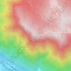
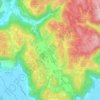
Asiago topographic map

Click on the map to display elevation.

About this map

Name: Asiago topographic map, elevation, terrain.

Location: Asiago, Vicenza, Veneto, 36012, Italy (45.81188 11.37232 46.01446 11.63462)

Average elevation: 4,311 ft

Minimum elevation: 745 ft

Maximum elevation: 7,615 ft

Other topographic maps

Click on a map to view its topography, its elevation and its terrain.

Cima di Marana

Italy > Veneto > Vicenza > Recoaro Terme

Average elevation: 3,612 ft

Monte Cengio

Italy > Veneto > Vicenza > Cogollo del Cengio

Monte Cengio is a mountain in the Asiago plateau, within the Vicentine Alps, in Veneto, northeastern Italy. It has an elevation of 1,354 metres and is located on the southwestern edge of the plateau, in the territory of Cogollo del Cengio.

Average elevation: 3,068 ft

Cima Portule

Italy > Veneto > Vicenza > Asiago

Cima Portule is a mountain in Italy, located in the province of Vicenza in the Veneto region. It has an elevation of 2,308 metres (7,572 ft).

Average elevation: 6,358 ft

Monte Pulgo

Italy > Veneto > Vicenza > Cornedo Vicentino > Montepulgo

Average elevation: 755 ft

Cima Dodici (Ferozzo)

Italy > Veneto > Vicenza > Asiago

Cima Dodici (Italian for "peak 12", in Cimbrian language Freyjoch) is a mountain on the border of Vicenza in Veneto and Trentino in Trentino Alto Adige, northern Italy, south of the village of Borgo Valsugana. It has an elevation of 2,336 metres. and is the highest peak in Vicenza. At 1,874 m prominence, it is…

Average elevation: 6,230 ft

Le Casare

Italy > Veneto > Vicenza > Brogliano > Quargnenta

Average elevation: 1,693 ft

Rudere

Italy > Veneto > Vicenza > Longare > Longare

Average elevation: 98 ft

Il Corso

Italy > Veneto > Vicenza > Vicenza > Santa Croce Bigolina

Average elevation: 118 ft

Arso

Italy > Veneto > Vicenza > Chiampo

Average elevation: 1,394 ft

San Zeno

Italy > Veneto > Vicenza > Cassola

Average elevation: 351 ft

Ospedaletto

Italy > Veneto > Vicenza > Vicenza

Average elevation: 121 ft

Motta

Italy > Veneto > Vicenza

Average elevation: 171 ft

Monte Cengio

Italy > Veneto > Vicenza > Cogollo del Cengio

Monte Cengio is a mountain in the Asiago plateau, within the Vicentine Alps, in Veneto, northeastern Italy. It has an elevation of 1,354 metres and is located on the southwestern edge of the plateau, in the territory of Cogollo del Cengio.

Average elevation: 3,068 ft
Primolano

Italy > Veneto > Vicenza

Average elevation: 1,909 ft

Parco del Buso della Rana

Italy > Veneto > Vicenza > Monte di Malo

Average elevation: 1,296 ft

Passo di Riva

Italy > Veneto > Vicenza > Dueville

Average elevation: 200 ft

Belvedere

Italy > Veneto > Vicenza

Average elevation: 223 ft

Tormeno

Italy > Veneto > Vicenza

Average elevation: 177 ft

Pozzolo

Italy > Veneto > Vicenza

Average elevation: 643 ft

Lago di Fimon

Italy > Veneto > Vicenza > Lapio > Casare

Average elevation: 397 ft

Campedello

Italy > Veneto > Vicenza > Vicenza

Average elevation: 151 ft

Valdellette

Italy > Veneto > Vicenza > Lugo di Vicenza

Average elevation: 869 ft

San Benedetto

Italy > Veneto > Vicenza

Average elevation: 180 ft

Fosse di Sopra

Italy > Veneto > Vicenza > Enego

Average elevation: 2,231 ft

Ponte di Ferro

Italy > Veneto > Vicenza > Thiene > Rozzampia

Average elevation: 413 ft

Gear up for your next adventure:

📶Satellite Messenger - Communication device off‑grid
🔭Stargazing Telescopes - Perfect for camping in low-light pollution areas shown on maps
🔦LED Headlamp - Bright and durable LED headlamp for night navigation
🕶️Glacier Sunglasses - Side shields to protect eyes from high-altitude snow glare
🔦Powerful Headlamps - Ultra-bright hands-free lighting for night navigation

As an Amazon Associate, this site earns from qualifying purchases at no extra cost to you.