Geolocate

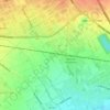
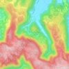
Malo topographic map

Click on the map to display elevation.

About this map

Name: Malo topographic map, elevation, terrain.

Location: Malo, Vicenza, Veneto, 36034, Italy (45.61597 11.38100 45.68545 11.47901)

Average elevation: 600 ft

Minimum elevation: 223 ft

Maximum elevation: 2,100 ft

Other topographic maps

Click on a map to view its topography, its elevation and its terrain.
Arso

Italy > Veneto > Vicenza > Chiampo

Average elevation: 1,394 ft

San Pietro

Italy > Veneto > Vicenza

Average elevation: 2,730 ft

La Gusela

Italy > Veneto > Vicenza > Cismon del Grappa

Average elevation: 1,824 ft

Sette

Italy > Veneto > Vicenza > San Vito di Leguzzano

Average elevation: 768 ft

Fosse di Sopra

Italy > Veneto > Vicenza > Enego

Average elevation: 2,231 ft

Rotz

Italy > Veneto > Vicenza > Gallio

Average elevation: 3,829 ft

Località Casoni

Italy > Veneto > Vicenza > Marano Vicentino

Average elevation: 505 ft

Troio

Italy > Veneto > Vicenza > Lusiana

Average elevation: 2,667 ft

Campanella

Italy > Veneto > Vicenza

Average elevation: 1,909 ft

Staro

Italy > Veneto > Vicenza

Average elevation: 2,116 ft

Villa di Fimon

Italy > Veneto > Vicenza > Fimon

Average elevation: 755 ft

Axe

Italy > Veneto > Vicenza > Posina

Average elevation: 2,887 ft

Frisoni

Italy > Veneto > Vicenza > Stoner

Average elevation: 3,596 ft

Clama

Italy > Veneto > Vicenza > Asiago > Clama

Average elevation: 3,461 ft

Gear up for your next adventure:

🛡️Bear Spray Outdoor - Protection in bear country hikes
🦺Reflective Outdoor Gear - Safety gear for low‑light conditions
🏔️Mountain Trail Maps - High‑detail maps for popular peaks
🪶Fire Starter Kit - Reliable fire starter for survival and camping
🎒Outdoor Daypacks - Lightweight backpacks designed for carrying maps and essential gear

As an Amazon Associate, this site earns from qualifying purchases at no extra cost to you.