
冷泉村 topographic map
Interactive map
Click on the map to display elevation.
About this map
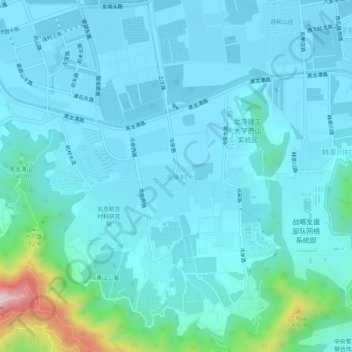
Name: 冷泉村 topographic map, elevation, terrain.
Location: 冷泉村, 海淀区, 北京市, 100094, 中国 (40.01298 116.19792 40.05298 116.23792)
Average elevation: 312 ft
Minimum elevation: 144 ft
Maximum elevation: 1,503 ft
Other topographic maps
Click on a map to view its topography, its elevation and its terrain.
北京西山国家森林公园
北京西山国家森林公园, 红枫路, 香山街道, 南辛村, 海淀区, 北京市, 100094, 中国
Average elevation: 810 ft