Geolocate

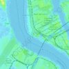
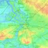
Berchem topographic map

Click on the map to display elevation.

About this map

Name: Berchem topographic map, elevation, terrain.

Location: Berchem, Antwerp, Flanders, 2600, Belgium (51.17670 4.41046 51.20724 4.45162)

Average elevation: 39 ft

Minimum elevation: -13 ft

Maximum elevation: 66 ft

Other topographic maps

Click on a map to view its topography, its elevation and its terrain.
Antwerp

Belgium > Antwerp > Antwerp > Antwerp

Average elevation: 16 ft

Lillo-Fort

Belgium > Antwerp > Antwerp > Antwerp

Average elevation: 10 ft

Antwerp

Belgium > Antwerp > Antwerp > Antwerp

Average elevation: 30 ft

Donk

Belgium > Antwerp > Antwerp > Antwerp > Ekeren

Average elevation: 20 ft

Gear up for your next adventure:

🪶Paracord Bracelet - Survival bracelet with built‑in tools
🔥Camping Stove - Portable stove for camping and backcountry cooking
🔥Fast-Boil Camping Stoves - Efficient cooking systems for quick trail meals
👟Trail Running Shoes - Lightweight shoes for trail runners
🛰️Satellite Messengers - Emergency SOS and two-way messaging for off-grid adventures

As an Amazon Associate, this site earns from qualifying purchases at no extra cost to you.