
Indian Valley topographic map
Click on the map to display elevation.
About this map
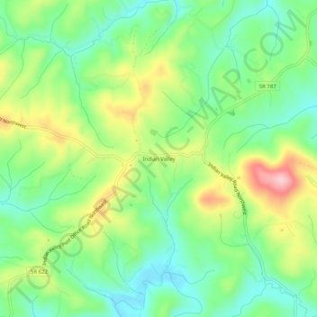
Name: Indian Valley topographic map, elevation, terrain.
Location: Indian Valley, Floyd County, Virginia, 24105, United States (36.88874 -80.57201 36.92874 -80.53201)
Average elevation: 2,608 ft
Minimum elevation: 2,365 ft
Maximum elevation: 3,022 ft
Floyd County trails, hiking, mountain biking, running and outdoor activities
Other topographic maps
Click on a map to view its topography, its elevation and its terrain.
Chestnut Creek Wetlands State Natural Area Preserve
United States > Virginia > Floyd County
Average elevation: 2,953 ft