Geolocate

Harder topographic map

Click on the map to display elevation.

About this map

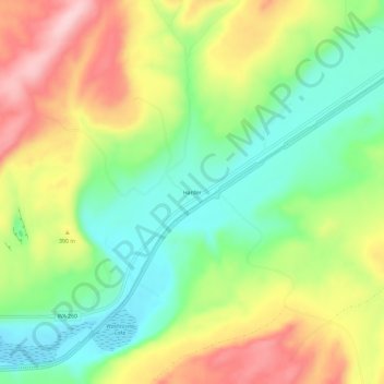
Name: Harder topographic map, elevation, terrain.

Location: Harder, Franklin County, Washington, United States (46.64344 -118.50744 46.68344 -118.46744)

Average elevation: 1,148 ft

Minimum elevation: 860 ft

Maximum elevation: 1,529 ft

Franklin County trails, hiking, mountain biking, running and outdoor activities

Other topographic maps

Click on a map to view its topography, its elevation and its terrain.

Basin City

United States > Washington > Franklin County

Average elevation: 725 ft

West Pasco

United States > Washington > Franklin County

Average elevation: 390 ft

Mesa

United States > Washington > Franklin County

Average elevation: 784 ft

Pasco

United States > Washington > Franklin County > Pasco

Average elevation: 541 ft

Gear up for your next adventure:

🥾Women's Hiking Boots - Top-rated trail boots with ankle support and superior grip
🧦Hiking Socks - Comfortable socks to prevent blisters on long hikes
🌡️Handheld Weather Meters - Measure wind, temp, and pressure for safe mountain travel
📱Solar Portable Charger - Solar power bank for charging devices off‑grid
🎁Geography Themed Gifts - Unique gift ideas for map lovers and geography enthusiasts

As an Amazon Associate, this site earns from qualifying purchases at no extra cost to you.