Geolocate
👉 Easily get elevation data in JSON, GeoTIFF and KML formats using Elevation API
Thank you for supporting this site ❤️
Make a donation

Comstock topographic map

Click on the map to display elevation.

About this map

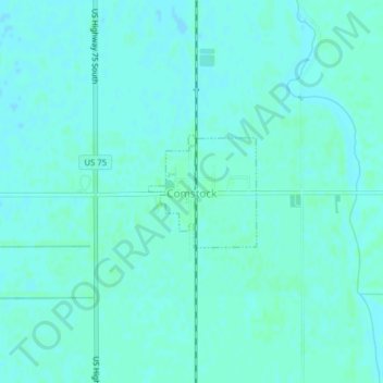
Name: Comstock topographic map, elevation, terrain.

Location: Comstock, Clay County, Minnesota, 56525, United States (46.65555 -96.75284 46.66346 -96.74177)

Average elevation: 922 ft

Minimum elevation: 915 ft

Maximum elevation: 932 ft

Clay County trails, hiking, mountain biking, running and outdoor activities

Other topographic maps

Click on a map to view its topography, its elevation and its terrain.

Baker

United States > Minnesota > Clay County

Average elevation: 938 ft

Hitterdahl WMA

United States > Minnesota > Clay County

Average elevation: 1,243 ft

Moorhead

United States > Minnesota > Clay County > Moorhead > Moorhead

Average elevation: 909 ft

Kragnes

United States > Minnesota > Clay County

Average elevation: 896 ft

Gear up for your next adventure:

🦶Hiking Gaiters - Keep debris and water out of your boots
🧴Hand Sanitizer - Keep hands clean while hiking
🛰️Handheld GPS Units - Professional satellite navigators for precise backcountry mapping
👟Trail Running Shoes - Lightweight shoes for trail runners
🎒Day Hiking Backpack - Lightweight backpack perfect for day trips and outdoor adventures

As an Amazon Associate, this site earns from qualifying purchases at no extra cost to you.