
Halanzy topographic map
Interactive map
Click on the map to display elevation.
About this map
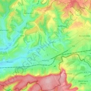
Name: Halanzy topographic map, elevation, terrain.
Location: Halanzy, Aubange, Aarlen, Luxemburg, Wallonië, 6792, België (49.53880 5.72725 49.59900 5.79829)
Average elevation: 1,010 ft
Minimum elevation: 781 ft
Maximum elevation: 1,339 ft
Other topographic maps
Click on a map to view its topography, its elevation and its terrain.