
Messancy topographic map
Interactive map
Click on the map to display elevation.
About this map
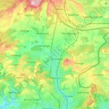
Name: Messancy topographic map, elevation, terrain.
Location: Messancy, Aarlen, Luxemburg, Wallonië, België (49.57195 5.72862 49.66006 5.88009)
Average elevation: 1,096 ft
Minimum elevation: 840 ft
Maximum elevation: 1,535 ft
Other topographic maps
Click on a map to view its topography, its elevation and its terrain.