
Marion topographic map
Click on the map to display elevation.
About this map
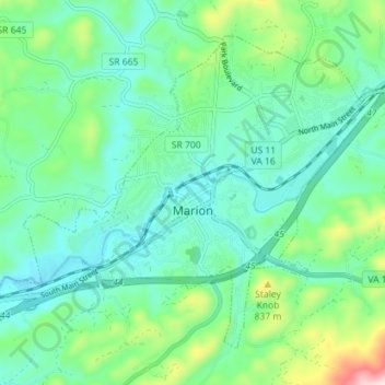
Name: Marion topographic map, elevation, terrain.
Location: Marion, Smyth County, Virginia, 24354, United States (36.81273 -81.55553 36.85890 -81.48452)
Average elevation: 2,333 ft
Minimum elevation: 2,054 ft
Maximum elevation: 3,232 ft
Smyth County trails, hiking, mountain biking, running and outdoor activities
Other topographic maps
Click on a map to view its topography, its elevation and its terrain.
Mount Rogers
United States > Virginia > Smyth County
Mount Rogers is the highest natural point in Virginia, United States, with a summit elevation of 5,729 ft (1,746 m) above mean sea level. The summit straddles the border of Grayson and Smyth Counties, Virginia, about 6.45 mi (10.38 km) WSW of Troutdale, Virginia. Most of the mountain is contained within the…
Average elevation: 4,944 ft