
头屯河区 topographic map
Interactive map
Click on the map to display elevation.
About this map
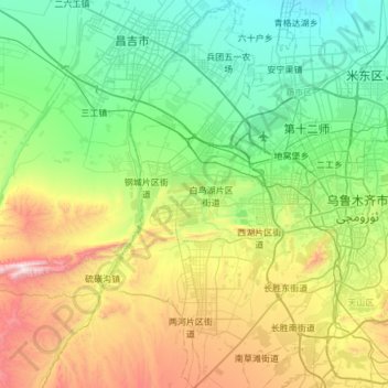
Name: 头屯河区 topographic map, elevation, terrain.
Location: 头屯河区, 乌鲁木齐市, 新疆维吾尔自治区, 830000, 中国 (43.62074 87.21855 44.05545 87.54778)
Average elevation: 2,976 ft
Minimum elevation: 1,647 ft
Maximum elevation: 6,568 ft
Other topographic maps
Click on a map to view its topography, its elevation and its terrain.