
岭口村 topographic map
Interactive map
Click on the map to display elevation.
About this map
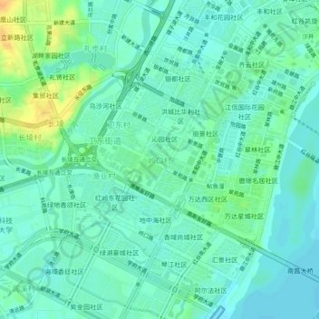
Name: 岭口村 topographic map, elevation, terrain.
Location: 岭口村, 红谷滩区, 南昌市, 江西省, 330038, 中国 (28.65845 115.81728 28.69845 115.85728)
Average elevation: 69 ft
Minimum elevation: 39 ft
Maximum elevation: 148 ft
Other topographic maps
Click on a map to view its topography, its elevation and its terrain.