Geolocate

Placerville topographic map

Click on the map to display elevation.

👉 Easily get elevation data in JSON, GeoTIFF and KML formats using Elevation API
Thank you for supporting this site ❤️
Make a donation

About this map

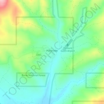
Name: Placerville topographic map, elevation, terrain.

Location: Placerville, Boise County, Idaho, 83666, United States (43.93549 -115.95604 43.95001 -115.93595)

Average elevation: 4,406 ft

Minimum elevation: 4,226 ft

Maximum elevation: 4,806 ft

Boise County trails, hiking, mountain biking, running and outdoor activities

Other topographic maps

Click on a map to view its topography, its elevation and its terrain.

Hawley Mountain

United States > Idaho > Boise County

Average elevation: 6,637 ft

Crouch

United States > Idaho > Boise County

Average elevation: 3,159 ft

Lowman

United States > Idaho > Boise County

Average elevation: 4,469 ft

North Raker

United States > Idaho > Boise County

Average elevation: 8,698 ft

Centerville

United States > Idaho > Boise County

Average elevation: 4,318 ft

Robie Creek

United States > Idaho > Boise County

Average elevation: 3,658 ft

Gear up for your next adventure:

🚪Portable Camp Chair - Foldable chair for comfort at camp
📦Dry Bags Set - Waterproof storage for electronics and clothes
🛰️Handheld GPS Units - Professional satellite navigators for precise backcountry mapping
🦶Hiking Gaiters - Keep debris and water out of your boots
🧣Merino Neck Gaiters - Multi-functional headwear for wind and sun protection

As an Amazon Associate, this site earns from qualifying purchases at no extra cost to you.