
Gum Spring topographic map
Click on the map to display elevation.
About this map
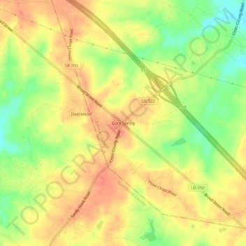
Name: Gum Spring topographic map, elevation, terrain.
Location: Gum Spring, Louisa County, Virginia, 23065, United States (37.75553 -77.91681 37.79553 -77.87681)
Average elevation: 335 ft
Minimum elevation: 230 ft
Maximum elevation: 400 ft
Louisa County trails, hiking, mountain biking, running and outdoor activities
Other topographic maps
Click on a map to view its topography, its elevation and its terrain.
Lake Anna
United States > Virginia > Louisa County
The dam creating the lake, North Anna Dam, is a 5,000-foot-long (1,524 m) and 90-foot-high (27 m) earthen embankment dam. It is 30 feet (9 m) wide at its crest which sits at an elevation of 265 feet (81 m) above sea level. The dam's spillway is located in the center of its body and is 200 feet (61 m) wide,…
Average elevation: 318 ft