Geolocate

Mineral topographic map

Click on the map to display elevation.

About this map

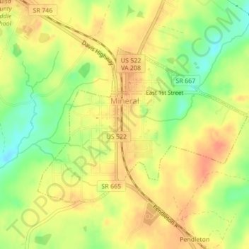
Name: Mineral topographic map, elevation, terrain.

Location: Mineral, Louisa County, Virginia, United States (37.99891 -77.91964 38.01562 -77.89074)

Average elevation: 436 ft

Minimum elevation: 348 ft

Maximum elevation: 489 ft

Louisa County trails, hiking, mountain biking, running and outdoor activities

Other topographic maps

Click on a map to view its topography, its elevation and its terrain.

Gum Spring

United States > Virginia > Louisa County

Average elevation: 335 ft

Bumpass

United States > Virginia > Louisa County

Average elevation: 305 ft

Zion Crossroads

United States > Virginia > Louisa County

Average elevation: 495 ft

Cuckoo

United States > Virginia > Louisa County

Average elevation: 377 ft

Louisa

United States > Virginia > Louisa County > Louisa

Average elevation: 427 ft

Gear up for your next adventure:

👟Men's Trail Runners - Lightweight footwear for fast-paced exploration and light hiking
🎒Trail Energy Bars - High‑calorie bars for hiking energy
🚁Photography Drones - Capture stunning aerial views of landforms and topography
📡GPS Antenna Upgrade - Enhance GPS reception in remote terrain
💧Water Purification System - Clean water on the trail with reliable purifiers

As an Amazon Associate, this site earns from qualifying purchases at no extra cost to you.