
Ozzie Cobb Lake Dam topographic map
Interactive map
Click on the map to display elevation.
About this map
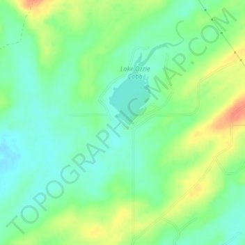
Name: Ozzie Cobb Lake Dam topographic map, elevation, terrain.
Average elevation: 548 ft
Minimum elevation: 492 ft
Maximum elevation: 633 ft
Other topographic maps
Click on a map to view its topography, its elevation and its terrain.
Pine Knot Crossing
United States > Oklahoma > Pushmataha County
Pine Knot Crossing, Pushmataha County, Oklahoma, United States
Average elevation: 522 ft
Antlers
United States > Oklahoma > Pushmataha County
Antlers, Pushmataha County, Oklahoma, United States
Average elevation: 505 ft
Kiamichi
United States > Oklahoma > Pushmataha County > Kiamichi
Kiamichi, Pushmataha County, Oklahoma, United States
Average elevation: 715 ft
Albion
United States > Oklahoma > Pushmataha County > Albion
Albion, Pushmataha County, Oklahoma, 74524, United States
Average elevation: 679 ft