Geolocate

Prospect topographic map

Click on the map to display elevation.

About this map

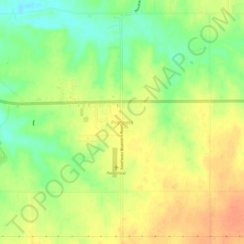
Name: Prospect topographic map, elevation, terrain.

Location: Prospect, Butler County, Kansas, United States (37.78696 -96.80919 37.82696 -96.76919)

Average elevation: 1,368 ft

Minimum elevation: 1,289 ft

Maximum elevation: 1,427 ft

Other topographic maps

Click on a map to view its topography, its elevation and its terrain.

Augusta

United States > Kansas > Butler County

Average elevation: 1,270 ft

Douglass

United States > Kansas > Butler County

Average elevation: 1,207 ft

Cassoday

United States > Kansas > Butler County

Average elevation: 1,476 ft

El Dorado

United States > Kansas > Butler County

Average elevation: 1,329 ft

Andover

United States > Kansas > Butler County

Average elevation: 1,332 ft

Whitewater

United States > Kansas > Butler County

Average elevation: 1,375 ft

El Dorado

United States > Kansas > Butler County

Average elevation: 1,329 ft

El Dorado

United States > Kansas > Butler County

Average elevation: 1,329 ft

Gear up for your next adventure:

Camping Coffee Makers - Enjoy premium coffee at the summit or campsite
🥩Freeze-Dried Meals - Nutritious and lightweight food for remote expeditions
🪶Survival Guide Book - Expert advice for emergency preparedness
🥇GPS Hiking Watch - Multi‑sport GPS watch with navigation and trail tracking
🎒Gear Packing Cubes - Organize your backpack efficiently

As an Amazon Associate, this site earns from qualifying purchases at no extra cost to you.