
West topographic map
Click on the map to display elevation.
About this map
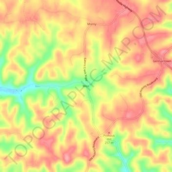
Name: West topographic map, elevation, terrain.
Average elevation: 771 ft
Minimum elevation: 558 ft
Maximum elevation: 892 ft
Davidson County trails, hiking, mountain biking, running and outdoor activities
Other topographic maps
Click on a map to view its topography, its elevation and its terrain.
Edwin Warner Park
United States > Tennessee > Davidson County > Nashville > Devonshire Manor
Average elevation: 650 ft
Harpeth River Greenway
United States > Tennessee > Davidson County > Nashville > Harpeth River Estates
Average elevation: 597 ft
J. Percy Priest Lake
United States > Tennessee > Davidson County > Nashville
Average elevation: 554 ft
Ellington Agricultural Center
United States > Tennessee > Davidson County > Nashville
Average elevation: 584 ft
Tennessee State Capitol
United States > Tennessee > Davidson County > Nashville
Average elevation: 456 ft