
Rock Island topographic map
Click on the map to display elevation.
About this map
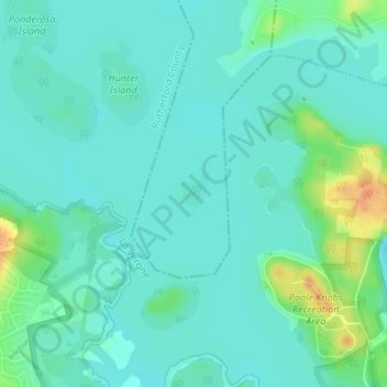
Name: Rock Island topographic map, elevation, terrain.
Average elevation: 505 ft
Minimum elevation: 476 ft
Maximum elevation: 600 ft
Davidson County trails, hiking, mountain biking, running and outdoor activities
Other topographic maps
Click on a map to view its topography, its elevation and its terrain.
J. Percy Priest Lake
United States > Tennessee > Davidson County > Nashville
Average elevation: 554 ft
Huntington Ridge Estates
United States > Tennessee > Davidson County > Nashville
Average elevation: 636 ft