Geolocate

Abu Ragwan topographic map

Click on the map to display elevation.

About this map

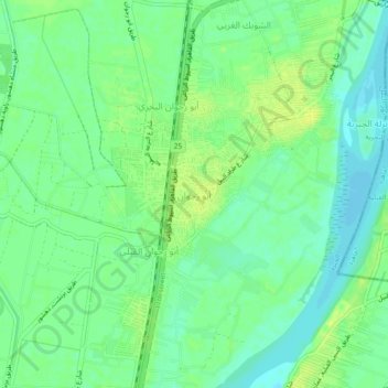
Name: Abu Ragwan topographic map, elevation, terrain.

Location: Abu Ragwan, Giza, 12924, Egypt (29.75412 31.24972 29.79412 31.28972)

Average elevation: 72 ft

Minimum elevation: 43 ft

Maximum elevation: 98 ft

Other topographic maps

Click on a map to view its topography, its elevation and its terrain.

Giza Pyramids

Egypt > Giza > Giza

Average elevation: 213 ft

Abo Al Nomros City

Egypt > Giza > Abu An Numrus

Average elevation: 66 ft

Giza Pyramids

Egypt > Giza > Giza

Average elevation: 213 ft

City View

Egypt > Giza

Average elevation: 213 ft

Al Haraneya Village

Egypt > Giza

Average elevation: 62 ft

Al Mounib

Egypt > Giza

Average elevation: 72 ft

Giza Pyramids

Egypt > Giza > Giza

Average elevation: 213 ft

Ard Al Lwaa'

Egypt > Giza > Nazlet Bahgat

Average elevation: 75 ft

Gezirat Dahab

Egypt > Giza

Average elevation: 69 ft

Jazirat Warraq al Hadar

Egypt > Giza > Tanaash

Average elevation: 66 ft

Ard Al Lwaa'

Egypt > Giza > Nazlet Bahgat

Average elevation: 75 ft

Kerdasa City

Egypt > Giza > Kirdasah

Average elevation: 92 ft

Sheikh Zayed

Egypt > Giza

Average elevation: 400 ft

Abu Sir

Egypt > Giza > Abu Sir

Average elevation: 144 ft

Nazlet Al Siman and Al Sisi

Egypt > Giza > Remaya Square

Average elevation: 138 ft

Qursaya

Egypt > Giza > Giza

Average elevation: 75 ft

Al Hosary park

Egypt > Giza > Sixth of October

Average elevation: 604 ft

El Hassana Dome Protectorate

Egypt > Giza > Sheikh Zayed

Average elevation: 354 ft

Gear up for your next adventure:

🪶Trail Camera - Capture wildlife on your hikes
🧯Portable Fire Pit - Compact fire pit for camping spots
🥘Titanium Cookware - Durable, featherlight pots and pans for backpacking
🧥Men's Rain Shells - Premium waterproof and breathable jackets for mountain weather
🕶️GPS Smartphone Mount - Secure mount for phone navigation

As an Amazon Associate, this site earns from qualifying purchases at no extra cost to you.