Geolocate

Moga topographic map

Click on the map to display elevation.

About this map

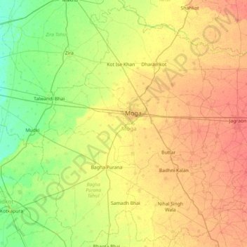
Name: Moga topographic map, elevation, terrain.

Location: Moga, Punjab, India (30.47712 74.90607 31.08853 75.41848)

Average elevation: 719 ft

Minimum elevation: 663 ft

Maximum elevation: 781 ft

Other topographic maps

Click on a map to view its topography, its elevation and its terrain.

Bulara

India > Punjab > Ludhiana (West) Tahsil

Average elevation: 833 ft

Joggers' Park

India > Punjab > Kharar Tahsil > Kharar

Average elevation: 1,030 ft

Jand

India > Punjab > Patti Tahsil

Average elevation: 689 ft

Jansla

India > Punjab > Rajpura Tahsil

Average elevation: 912 ft

Alampur

India > Punjab > Bassi Pathana Tahsil

Average elevation: 906 ft

Kulana

India > Punjab > Budhlada Tahsil

Average elevation: 725 ft

Ludhiana

India > Punjab > Ludhiana (West) Tahsil

Ludhiana is located at 30°54′N 75°51′E / 30.9°N 75.85°E / 30.9; 75.85. It has an average elevation of 244 metres (801 ft). Ludhiana City, to its residents, consists of the Old City and the New City. The new city primarily consists of the Civil Lines area which was historically known as the…

Average elevation: 810 ft

Lalru

India > Punjab > Dera Bassi Tahsil

Average elevation: 925 ft

Bathinda

India > Punjab > Bathinda Tahsil

Bathinda is in the northwestern region of India and is a part of the Indo-Gangetic alluvial plains. The exact cartographic co-ordinates of Bathinda are 30°12′N 74°57′E / 30.20°N 74.95°E / 30.20; 74.95. It has an average elevation of 201 metres (660 ft).

Average elevation: 682 ft

Zira

India > Punjab > Zira Tahsil

Average elevation: 696 ft

Raja Sansi

India > Punjab > Ajnala Tahsil

Average elevation: 755 ft

Sanghar

India > Punjab > Gurdaspur Tahsil > Sanghar

Average elevation: 840 ft

Dhariwal

India > Punjab > Dhariwal

Average elevation: 853 ft

Gurney

India > Punjab > Lehra Tahsil > Gurney

Average elevation: 738 ft

Rahon

India > Punjab > Nawanshahr Tahsil > Rahon

Average elevation: 840 ft

Jalalabad

India > Punjab > Khadur Sahib Tahsil > Jalalabad

Average elevation: 748 ft

Dhar

India > Punjab > Dhar Kalan Tahsil

Average elevation: 1,946 ft

Sri Muktsar Sahib

India > Punjab > Muktsar Tahsil

Average elevation: 646 ft

Sawaddi Kalan

India > Punjab > Jagraon Tahsil

Average elevation: 778 ft

Pakhowal

India > Punjab > Raikot Tahsil

Average elevation: 804 ft

Gear up for your next adventure:

📻Weather Alert Radios - Stay informed of storm risks while off-the-grid
🧯Portable Fire Pit - Compact fire pit for camping spots
🪑Ultralight Camp Chairs - Portable seating for resting after a long day of mapping
🪓Survival Multi‑Tool - Versatile tool for camp and trail tasks
🛠️Backpacking Tool Kit - Essential toolkit for outdoor repairs

As an Amazon Associate, this site earns from qualifying purchases at no extra cost to you.