Geolocate

Province of Jaén topographic map

Click on the map to display elevation.

About this map

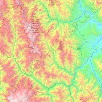
Name: Province of Jaén topographic map, elevation, terrain.

Location: Province of Jaén, Cajamarca, Peru (-6.13406 -79.42051 -5.32494 -78.51128)

Average elevation: 5,787 ft

Minimum elevation: 1,217 ft

Maximum elevation: 13,035 ft

Other topographic maps

Click on a map to view its topography, its elevation and its terrain.

Callancas

Peru > Cajamarca > San Pablo

Average elevation: 9,921 ft

Santa Cruz

Peru > Cajamarca

Average elevation: 1,677 ft

El Cardon

Peru > Cajamarca > Cutervo

Average elevation: 7,598 ft

Cruz De Chalpon

Peru > Cajamarca > San Ignacio

Average elevation: 4,882 ft

Regalado

Peru > Cajamarca > Tumbaden

Average elevation: 10,840 ft

Alto Otuzco

Peru > Cajamarca > Los Baños del Inca > Otuzco

Average elevation: 9,275 ft

Yube

Peru > Cajamarca > Callayuc

Average elevation: 5,213 ft

Gear up for your next adventure:

🥇GPS Hiking Watch - Multi‑sport GPS watch with navigation and trail tracking
🛠️Backpacking Tool Kit - Essential toolkit for outdoor repairs
🎒Outdoor Daypacks - Lightweight backpacks designed for carrying maps and essential gear
📚USA Hiking Guide Books - Top trail guides and map books
Camping Coffee Makers - Enjoy premium coffee at the summit or campsite

As an Amazon Associate, this site earns from qualifying purchases at no extra cost to you.