
Mugeni topographic map
Interactive map
Click on the map to display elevation.
About this map
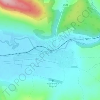
Name: Mugeni topographic map, elevation, terrain.
Location: Mugeni, Harghita, 537205, Romania (46.25310 25.20878 46.26223 25.23098)
Average elevation: 1,575 ft
Minimum elevation: 1,427 ft
Maximum elevation: 2,159 ft
Other topographic maps
Click on a map to view its topography, its elevation and its terrain.
Carpathian Mountains
Carpathian Mountains, Toplița, Harghita, 535705, Romania
Average elevation: 3,215 ft
Miercurea Ciuc
Romania > Harghita > Miercurea Ciuc
Miercurea Ciuc, Harghita, Romania
Average elevation: 2,260 ft