
Make a donation
Gear up for your next adventure:
As an Amazon Associate, this site earns from qualifying purchases at no extra cost to you.
Cedar Mountain topographic map
Click on the map to display elevation.
Make a donation
Gear up for your next adventure:
As an Amazon Associate, this site earns from qualifying purchases at no extra cost to you.
About this map
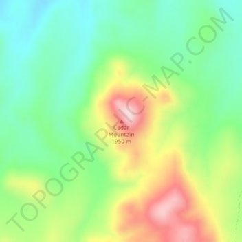
Name: Cedar Mountain topographic map, elevation, terrain.
Location: Cedar Mountain, Elko County, Nevada, United States (41.76042 -114.17979 41.76052 -114.17969)
Average elevation: 6,017 ft
Minimum elevation: 5,673 ft
Maximum elevation: 6,575 ft
Elko County trails, hiking, mountain biking, running and outdoor activities
Make a donation
Gear up for your next adventure:
As an Amazon Associate, this site earns from qualifying purchases at no extra cost to you.
Other topographic maps
Click on a map to view its topography, its elevation and its terrain.
Angel Lake
United States > Nevada > Elko County
Angel Lake is a glacial tarn in the northern part of the East Humboldt Range, in central Elko County in the northeastern part of the state of Nevada. It is located at approximately 41°01.6′N 115°05.1′W / 41.0267°N 115.0850°W / 41.0267; -115.0850, and at an elevation of 8378 feet (2553 m). It…
Average elevation: 8,766 ft
Make a donation
Gear up for your next adventure:
As an Amazon Associate, this site earns from qualifying purchases at no extra cost to you.