
Make a donation
Gear up for your next adventure:
As an Amazon Associate, this site earns from qualifying purchases at no extra cost to you.
Brunswick Village topographic map
Click on the map to display elevation.
Make a donation
Gear up for your next adventure:
As an Amazon Associate, this site earns from qualifying purchases at no extra cost to you.
About this map
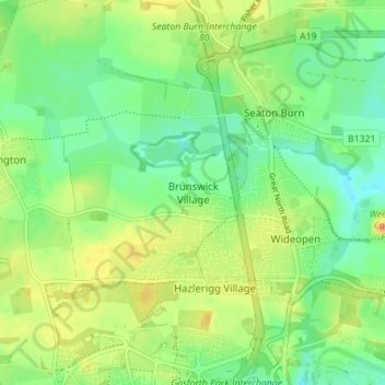
Name: Brunswick Village topographic map, elevation, terrain.
Average elevation: 213 ft
Minimum elevation: 161 ft
Maximum elevation: 276 ft
Make a donation
Gear up for your next adventure:
As an Amazon Associate, this site earns from qualifying purchases at no extra cost to you.
Other topographic maps
Click on a map to view its topography, its elevation and its terrain.
Fencerhill Wood Nature Reserve
United Kingdom > England > Newcastle upon Tyne
Average elevation: 184 ft
Hazlerigg
United Kingdom > England > Newcastle upon Tyne > Hazlerigg Village
Average elevation: 217 ft
Make a donation
Gear up for your next adventure:
As an Amazon Associate, this site earns from qualifying purchases at no extra cost to you.