
Hummelstown topographic map
Click on the map to display elevation.
Hummelstown
Hummelstown is located in southern Dauphin County at 40°15′55″N 076°42′30″W / 40.26528°N 76.70833°W / 40.26528; -76.70833 (40.265168, −76.710995) at an elevation of 397 feet (121 m) above sea level. According to the United States Census Bureau, the borough has a total area of 1.3 square miles (3.4 km2), of which 1.2 square miles (3.2 km2) is land and 0.1 square miles (0.2 km2), or 6.31%, is water. Swatara Creek, a southward-flowing tributary of the Susquehanna River, forms the northern and western border of Hummelstown, and there is one unnamed pond by the Hummel Nature Trail east of the 7–11, at the end of town, next to the Tee Ball baseball field.
About this map
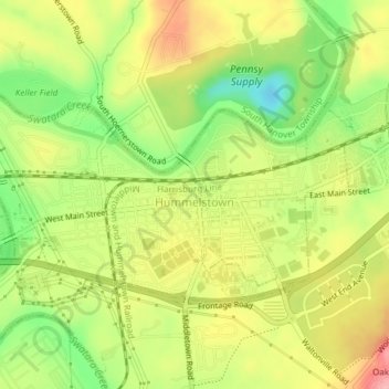
Name: Hummelstown topographic map, elevation, terrain.
Average elevation: 384 ft
Minimum elevation: 177 ft
Maximum elevation: 581 ft
Dauphin County trails, hiking, mountain biking, running and outdoor activities
Other topographic maps
Click on a map to view its topography, its elevation and its terrain.
Fort Hunter
United States > Pennsylvania > Dauphin County > Middle Paxton Township
Average elevation: 489 ft
Fisherville
United States > Pennsylvania > Dauphin County > Jackson Township
Average elevation: 604 ft
Reservoir Heights
United States > Pennsylvania > Dauphin County > Upper Paxton Township
Average elevation: 620 ft
Blue Mountain
United States > Pennsylvania > Dauphin County > Middle Paxton Township
The ridge of Blue Mountain runs for 150 miles (240 km) through Pennsylvania, reaching an elevation of 2,270 feet (690 m) above sea level just north of the Pennsylvania Turnpike, near the borough of Newburg. Most of the ridgecrest, however, only reaches between 1,400 and 1,700 feet (430 and 520 m) in elevation.…
Average elevation: 653 ft
Susquehanna River
United States > Pennsylvania > Dauphin County > Middle Paxton Township
Average elevation: 387 ft
Wiconisco
United States > Pennsylvania > Dauphin County > Wiconisco Township
Average elevation: 1,083 ft
Manor Acres
United States > Pennsylvania > Dauphin County > West Hanover Township > Skyline View
Average elevation: 489 ft
Susquehanna River
United States > Pennsylvania > Dauphin County > Susquehanna Township > Montrose Park
Average elevation: 374 ft
Fort Hunter
United States > Pennsylvania > Dauphin County > Middle Paxton Township
Average elevation: 489 ft
Pine Acres
United States > Pennsylvania > Dauphin County > West Hanover Township > Skyline View
Average elevation: 486 ft
Mauntain View Lake
United States > Pennsylvania > Dauphin County > Halifax Township
Average elevation: 679 ft