
Hechi topographic map
Interactive map
Click on the map to display elevation.
About this map
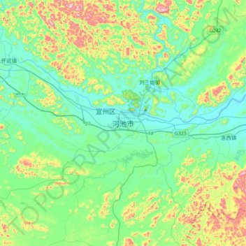
Name: Hechi topographic map, elevation, terrain.
Location: Hechi, 宜州区, Hechi, Guangxi, China (24.32799 108.47252 24.64799 108.79252)
Average elevation: 843 ft
Minimum elevation: 390 ft
Maximum elevation: 2,185 ft
Other topographic maps
Click on a map to view its topography, its elevation and its terrain.