
Hoboken topographic map
Click on the map to display elevation.
About this map
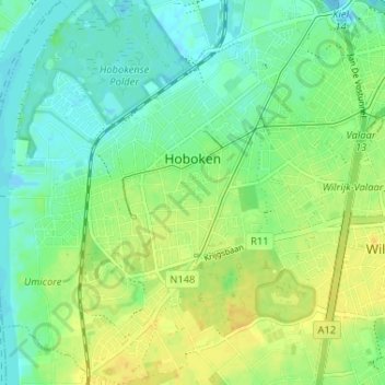
Name: Hoboken topographic map, elevation, terrain.
Location: Hoboken, Antwerp, Flanders, 2660, Belgium (51.15556 4.32799 51.19617 4.37829)
Average elevation: 36 ft
Minimum elevation: -26 ft
Maximum elevation: 75 ft
Other topographic maps
Click on a map to view its topography, its elevation and its terrain.