
Montverde topographic map
Click on the map to display elevation.
Montverde
Montverde is located in southeastern Lake County at 28°35′58″N 81°40′34″W / 28.599476°N 81.676221°W / 28.599476; -81.676221, on the southwest shore of Lake Apopka. The town sits on hills that rise 50 to 100 feet (15 to 30 m) above the elevation of the lake. It is 18 miles (29 km) south of Tavares, the Lake county seat, and 24 miles (39 km) northwest of Orlando.
About this map
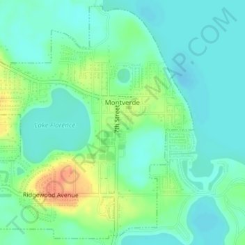
Name: Montverde topographic map, elevation, terrain.
Location: Montverde, Lake County, Florida, 34756, United States (28.58523 -81.69418 28.61090 -81.66499)
Average elevation: 89 ft
Minimum elevation: 43 ft
Maximum elevation: 190 ft
Lake County trails, hiking, mountain biking, running and outdoor activities
Other topographic maps
Click on a map to view its topography, its elevation and its terrain.
Orange Blossom Hills South
United States > Florida > Lake County > The Villages
Average elevation: 85 ft