Geolocate

La Paz topographic map

Click on the map to display elevation.

About this map

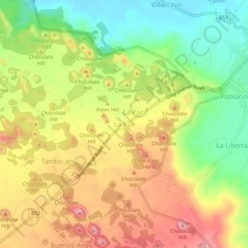
Name: La Paz topographic map, elevation, terrain.

Location: La Paz, Bohol, Central Visayas, 6319, Philippines (9.79251 124.15577 9.83251 124.19577)

Average elevation: 902 ft

Minimum elevation: 623 ft

Maximum elevation: 1,188 ft

Other topographic maps

Click on a map to view its topography, its elevation and its terrain.

Tabalong

Philippines > Bohol > Dauis

Average elevation: 62 ft

Pamilacan Island

Philippines > Bohol > Pamilacan

Average elevation: 7 ft

Maribojoc

Philippines > Bohol

Average elevation: 223 ft

Malinao Dam

Philippines > Bohol > Del Pilar

Average elevation: 499 ft

Tagbilaran

Philippines > Bohol

Average elevation: 82 ft

Bingag

Philippines > Bohol > Dauis

Average elevation: 62 ft

creek

Philippines > Bohol > Duero

Average elevation: 39 ft

Biking

Philippines > Bohol > Dauis

Average elevation: 187 ft

Candijay

Philippines > Bohol

Average elevation: 312 ft

Batas Island

Philippines > Bohol > Batasan

Average elevation: 0 ft

Gear up for your next adventure:

🪑Ultralight Camp Chairs - Portable seating for resting after a long day of mapping
🛠️Backpacking Tool Kit - Essential toolkit for outdoor repairs
🍳Camping Cook Set - Complete cookware for outdoor meals
🪶Compact Camp Shovel - Folding shovel for campsite tasks
🧯Portable Fire Pit - Compact fire pit for camping spots

As an Amazon Associate, this site earns from qualifying purchases at no extra cost to you.