
Graceville topographic map
Interactive map
Click on the map to display elevation.
About this map
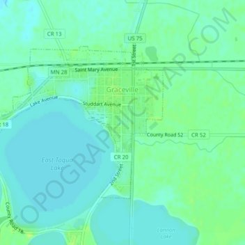
Name: Graceville topographic map, elevation, terrain.
Average elevation: 1,106 ft
Minimum elevation: 1,089 ft
Maximum elevation: 1,129 ft
Other topographic maps
Click on a map to view its topography, its elevation and its terrain.
Johnson
United States > Minnesota > Big Stone County
Johnson, Big Stone County, Minnesota, United States
Average elevation: 1,135 ft
Ortonville
United States > Minnesota > Big Stone County
Ortonville, Big Stone County, Minnesota, 56278, United States
Average elevation: 1,043 ft
Odessa
United States > Minnesota > Big Stone County
Odessa, Big Stone County, Minnesota, United States
Average elevation: 981 ft
Barry
United States > Minnesota > Big Stone County
Barry, Big Stone County, Minnesota, 56210, United States
Average elevation: 1,109 ft
Correll
United States > Minnesota > Big Stone County
Correll, Big Stone County, Minnesota, United States
Average elevation: 981 ft
Beardsley
United States > Minnesota > Big Stone County
Beardsley, Big Stone County, Minnesota, United States
Average elevation: 1,102 ft
Clinton
United States > Minnesota > Big Stone County
Clinton, Big Stone County, Minnesota, 56225, United States
Average elevation: 1,155 ft