Geolocate

Jules topographic map

Click on the map to display elevation.

About this map

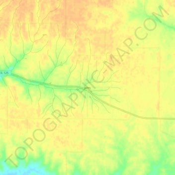
Name: Jules topographic map, elevation, terrain.

Location: Jules, Cass County, Illinois, 62691, United States (39.94810 -90.28040 39.98810 -90.24040)

Average elevation: 623 ft

Minimum elevation: 545 ft

Maximum elevation: 650 ft

Cass County trails, hiking, mountain biking, running and outdoor activities

Other topographic maps

Click on a map to view its topography, its elevation and its terrain.

Virginia

United States > Illinois > Cass County

Average elevation: 617 ft

Beardstown

United States > Illinois > Cass County

Average elevation: 446 ft

Ashland

United States > Illinois > Cass County

Average elevation: 636 ft

Arenzville

United States > Illinois > Cass County

Average elevation: 525 ft

Gear up for your next adventure:

📶Satellite Messenger - Communication device off‑grid
📱Solar Portable Charger - Solar power bank for charging devices off‑grid
🗺️Topographic Maps - Detailed topo maps for hiking, exploring and outdoor navigation
🕶️Glacier Sunglasses - Side shields to protect eyes from high-altitude snow glare
😴Insulated Sleeping Pads - Compact and warm pads for high-elevation camping

As an Amazon Associate, this site earns from qualifying purchases at no extra cost to you.