Geolocate

Sena topographic map

Click on the map to display elevation.

About this map

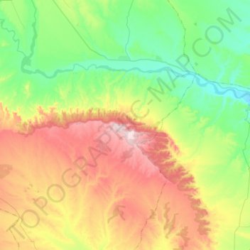
Name: Sena topographic map, elevation, terrain.

Location: Sena, Los Monegros, Aragon, Spain (41.56420 -0.15946 41.76191 -0.02150)

Average elevation: 1,083 ft

Minimum elevation: 558 ft

Maximum elevation: 1,936 ft

Other topographic maps

Click on a map to view its topography, its elevation and its terrain.

Montemar

Spain > Aragon > Los Monegros > Farlete

Average elevation: 2,146 ft

Ordesa

Spain > Aragon > Los Monegros > Almuniente

Average elevation: 1,119 ft

Gear up for your next adventure:

🌄Hiking Binoculars - Compact binoculars for scenic views and trail spotting
🧥Men's Rain Shells - Premium waterproof and breathable jackets for mountain weather
📦Dry Bags Set - Waterproof storage for electronics and clothes
📷Action Cameras - Rugged cameras to document your journeys across rugged terrain
🎁Geography Themed Gifts - Unique gift ideas for map lovers and geography enthusiasts

As an Amazon Associate, this site earns from qualifying purchases at no extra cost to you.