Geolocate

Hoisington topographic map

Click on the map to display elevation.

About this map

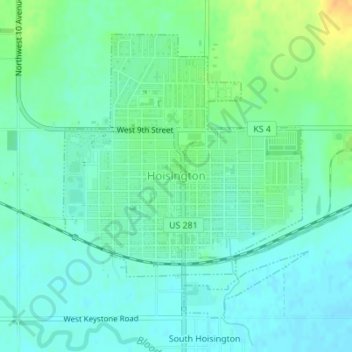
Name: Hoisington topographic map, elevation, terrain.

Location: Hoisington, Barton County, Kansas, 67544, United States (38.50715 -98.78921 38.52889 -98.76511)

Average elevation: 1,844 ft

Minimum elevation: 1,811 ft

Maximum elevation: 1,913 ft

Barton County trails, hiking, mountain biking, running and outdoor activities

Other topographic maps

Click on a map to view its topography, its elevation and its terrain.

Dubuque

United States > Kansas > Barton County

Average elevation: 1,877 ft

Odin

United States > Kansas > Barton County

Average elevation: 1,854 ft

Beaver

United States > Kansas > Barton County

Average elevation: 1,913 ft

Barton Lake

United States > Kansas > Barton County

Average elevation: 1,890 ft

Gear up for your next adventure:

🥘Titanium Cookware - Durable, featherlight pots and pans for backpacking
🛡️Bear Spray Outdoor - Protection in bear country hikes
🚑Emergency Bivvies - Heat-reflective sleeping bags for survival situations
🏕️Tent Footprint - Protect your tent base from wear
🏔️Mountain Trail Maps - High‑detail maps for popular peaks

As an Amazon Associate, this site earns from qualifying purchases at no extra cost to you.