Geolocate

Barton Lake topographic map

Click on the map to display elevation.

About this map

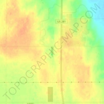
Name: Barton Lake topographic map, elevation, terrain.

Location: Barton Lake, Barton County, Kansas, United States (38.44610 -98.77849 38.44888 -98.77757)

Average elevation: 1,890 ft

Minimum elevation: 1,811 ft

Maximum elevation: 1,926 ft

Barton County trails, hiking, mountain biking, running and outdoor activities

Other topographic maps

Click on a map to view its topography, its elevation and its terrain.

Dubuque

United States > Kansas > Barton County

Average elevation: 1,877 ft

Odin

United States > Kansas > Barton County

Average elevation: 1,854 ft

Beaver

United States > Kansas > Barton County

Average elevation: 1,913 ft

Hoisington

United States > Kansas > Barton County

Average elevation: 1,844 ft

Cheyenne Bottoms

United States > Kansas > Barton County

Average elevation: 1,821 ft

Gear up for your next adventure:

🔦Compact Flashlight - Reliable flashlight for emergencies
🚁Photography Drones - Capture stunning aerial views of landforms and topography
🧼Biodegradable Camping Soap - Eco‑friendly soap for outdoor hygiene
🔊Portable Camp Speaker - Music and alerts at camp
🧣Hiking Neck Gaiter - Multi‑use neck protection for outdoor weather

As an Amazon Associate, this site earns from qualifying purchases at no extra cost to you.