
Oakington topographic map
Click on the map to display elevation.
About this map
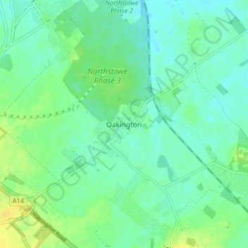
Name: Oakington topographic map, elevation, terrain.
Average elevation: 43 ft
Minimum elevation: 16 ft
Maximum elevation: 85 ft
Other topographic maps
Click on a map to view its topography, its elevation and its terrain.
Shingay cum Wendy
United Kingdom > England > Cambridgeshire > South Cambridgeshire > Wendy
Average elevation: 92 ft
West Wratting
United Kingdom > England > Cambridgeshire > South Cambridgeshire
Average elevation: 302 ft
Great Abington
United Kingdom > England > Cambridgeshire > South Cambridgeshire
Average elevation: 180 ft
Great Shelford
United Kingdom > England > Cambridgeshire > South Cambridgeshire
Average elevation: 72 ft
West Wickham
United Kingdom > England > Cambridgeshire > South Cambridgeshire
Average elevation: 338 ft
Dry Drayton
United Kingdom > England > Cambridgeshire > South Cambridgeshire
Average elevation: 138 ft
Papworth Everard
United Kingdom > England > Cambridgeshire > South Cambridgeshire
Average elevation: 167 ft
Chittering
United Kingdom > England > Cambridgeshire > South Cambridgeshire > Waterbeach
Average elevation: 10 ft
Great Eversden
United Kingdom > England > Cambridgeshire > South Cambridgeshire
Average elevation: 135 ft
Little Abington
United Kingdom > England > Cambridgeshire > South Cambridgeshire
Average elevation: 151 ft
Bassingbourn cum Kneesworth
United Kingdom > England > Cambridgeshire > South Cambridgeshire
Average elevation: 128 ft
Little Shelford
United Kingdom > England > Cambridgeshire > South Cambridgeshire
Average elevation: 62 ft
Stow cum Quy
United Kingdom > England > Cambridgeshire > South Cambridgeshire
Average elevation: 30 ft
Castle Camps
United Kingdom > England > Cambridgeshire > South Cambridgeshire
Average elevation: 361 ft
Weston Colville
United Kingdom > England > Cambridgeshire > South Cambridgeshire
Average elevation: 335 ft
Whittlesford
United Kingdom > England > Cambridgeshire > South Cambridgeshire
Average elevation: 89 ft
Guilden Morden
United Kingdom > England > Cambridgeshire > South Cambridgeshire
Average elevation: 164 ft
Little Gransden
United Kingdom > England > Cambridgeshire > South Cambridgeshire
Average elevation: 223 ft
Nine Wells
United Kingdom > England > Cambridgeshire > South Cambridgeshire > Great Shelford
Average elevation: 66 ft
Grantchester
United Kingdom > England > Cambridgeshire > South Cambridgeshire
Average elevation: 49 ft
Haslingfield
United Kingdom > England > Cambridgeshire > South Cambridgeshire
Average elevation: 79 ft
Shudy Camps
United Kingdom > England > Cambridgeshire > South Cambridgeshire > Shudy Camps
Average elevation: 341 ft
Knapwell
United Kingdom > England > Cambridgeshire > South Cambridgeshire > Knapwell
Average elevation: 184 ft
Gamlingay Wood NR
United Kingdom > England > Cambridgeshire > South Cambridgeshire > Gamlingay
Average elevation: 184 ft
Hayley Wood NR
United Kingdom > England > Cambridgeshire > South Cambridgeshire > Hatley
Average elevation: 249 ft
Tadlow
United Kingdom > England > Cambridgeshire > South Cambridgeshire > Tadlow
Average elevation: 157 ft
Little Eversden
United Kingdom > England > Cambridgeshire > South Cambridgeshire
Average elevation: 115 ft
Great Shelford
United Kingdom > England > Cambridgeshire > South Cambridgeshire
Average elevation: 72 ft