Geolocate

Howick topographic map

Click on the map to display elevation.

About this map

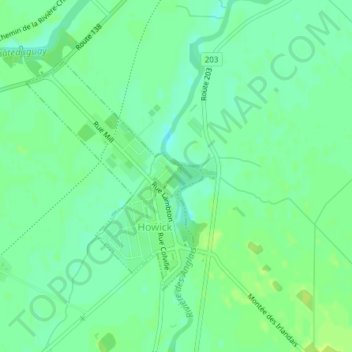
Name: Howick topographic map, elevation, terrain.

Location: Howick, Le Haut-Saint-Laurent, Montérégie, Quebec, Canada (45.18002 -73.86311 45.19759 -73.84385)

Average elevation: 128 ft

Minimum elevation: 105 ft

Maximum elevation: 148 ft

Other topographic maps

Click on a map to view its topography, its elevation and its terrain.

Cazaville

Canada > Quebec > Le Haut-Saint-Laurent

Average elevation: 190 ft

North Georgetown

Canada > Quebec > Le Haut-Saint-Laurent

Average elevation: 131 ft

Snye

Canada > Quebec > Le Haut-Saint-Laurent > Snye

Average elevation: 161 ft

Covey Hill

Canada > Quebec > Le Haut-Saint-Laurent > Havelock

Average elevation: 928 ft

Doréa

Canada > Quebec > Le Haut-Saint-Laurent > Franklin

Average elevation: 794 ft

Powerscourt

Canada > Quebec > Le Haut-Saint-Laurent > Hinchinbrooke

Average elevation: 299 ft

Gear up for your next adventure:

🧣Hiking Neck Gaiter - Multi‑use neck protection for outdoor weather
⛑️Personal Locator Beacon - Safety beacon for emergencies
🧯Portable Fire Pit - Compact fire pit for camping spots
🧭Hiking Compass - Precision compass for reliable navigation in the wilderness
🧢Sun Protection Hats - Wide-brimmed and UPF-rated hats for high-altitude sun safety

As an Amazon Associate, this site earns from qualifying purchases at no extra cost to you.