
Lytton topographic map
Interactive map
Click on the map to display elevation.
Lytton
Lytton experiences an inland warm-summer mediterranean climate (Csb), using the -3 °C isotherm, or a dry-summer continental climate (Dsb), using the 0 °C isotherm. During summer heat waves, Lytton is often the hottest spot in Canada, despite its location north of 50°N in latitude. Because of the dry summer air and a relatively low elevation of 195 m (640 ft), summer afternoon shade temperatures frequently reach 35 °C (95 °F) and occasionally top 40 °C (104 °F). Lytton holds the record for the highest temperature ever recorded in Canada with a record high of 49.6 °C (121.3 °F) on June 29 of the 2021 Western North America heat wave. This occurred after having already broken records multiple times during the previous days of that heat wave. This is the world's highest temperature ever recorded north of the 45th parallel. The previous record was 121 °F (49.4 °C) in Steele, North Dakota on July 6, 1936. Lytton has recorded a higher temperature than all but 4 U.S. states, with only Arizona, California, New Mexico, and Nevada ever recording higher temperatures. Lytton has also recorded higher temperatures than all of Europe and South America have ever recorded.
About this map
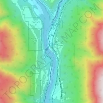
Name: Lytton topographic map, elevation, terrain.
Average elevation: 1,716 ft
Minimum elevation: 413 ft
Maximum elevation: 4,459 ft
Other topographic maps
Click on a map to view its topography, its elevation and its terrain.
Whitecroft
Canada > British Columbia > Thompson-Nicola Regional District > Area P (Rivers and the Peaks)
Average elevation: 3,281 ft
Mount Cahilty
Canada > British Columbia > Thompson-Nicola Regional District > Area O (Lower North Thompson)
Average elevation: 5,696 ft
Arthur Seat
Canada > British Columbia > Thompson-Nicola Regional District > Area I (Blue Sky Country)
Average elevation: 4,354 ft
Kamloops
Canada > British Columbia > Thompson-Nicola Regional District > Kamloops
Average elevation: 2,871 ft
Glimpse Lake
Canada > British Columbia > Thompson-Nicola Regional District > Area M (Beautiful Nicola Valley - North)
Average elevation: 3,973 ft
Thompson Glacier
Canada > British Columbia > Thompson-Nicola Regional District > Area B (Thompson Headwaters)
Average elevation: 7,589 ft
Stake Lake
Canada > British Columbia > Thompson-Nicola Regional District > Area J (Copper Desert Country)
Average elevation: 4,432 ft
Riley Dam Recreation Site
Canada > British Columbia > Thompson-Nicola Regional District > Area E (Bonaparte Plateau)
Average elevation: 3,533 ft
Sun Peaks Mountain Resort Municipality
Canada > British Columbia > Thompson-Nicola Regional District
Average elevation: 5,213 ft
Jacko Lake
Canada > British Columbia > Thompson-Nicola Regional District > Area J (Copper Desert Country)
Average elevation: 3,054 ft
Brookmere
Canada > British Columbia > Thompson-Nicola Regional District > Area N (Beautiful Nicola Valley - South)
Average elevation: 3,780 ft
Aspen Grove
Canada > British Columbia > Thompson-Nicola Regional District > Area N (Beautiful Nicola Valley - South)
Average elevation: 3,822 ft
Monte Lake
Canada > British Columbia > Thompson-Nicola Regional District > Area L (Grasslands)
Average elevation: 2,828 ft
Mount Tod
Canada > British Columbia > Thompson-Nicola Regional District > Sun Peaks Mountain Resort Municipality
Average elevation: 6,316 ft
Eleanor Lake
Canada > British Columbia > Thompson-Nicola Regional District > Area B (Thompson Headwaters) > Blue River
Average elevation: 2,280 ft
Powerline Lake
Canada > British Columbia > Thompson-Nicola Regional District > Area L (Grasslands)
Average elevation: 3,986 ft
Kentucky Lake
Canada > British Columbia > Thompson-Nicola Regional District > Area N (Beautiful Nicola Valley - South)
Average elevation: 3,668 ft
Savona
Canada > British Columbia > Thompson-Nicola Regional District > Area J (Copper Desert Country)
Average elevation: 1,575 ft
Fatox Lake
Canada > British Columbia > Thompson-Nicola Regional District > Area J (Copper Desert Country)
Average elevation: 3,848 ft
Strait Lake
Canada > British Columbia > Thompson-Nicola Regional District > Area A (Wells Gray Country)
Average elevation: 5,023 ft
Clifford Lake
Canada > British Columbia > Thompson-Nicola Regional District > Area N (Beautiful Nicola Valley - South)
Average elevation: 3,560 ft
Westwold
Canada > British Columbia > Thompson-Nicola Regional District > Area L (Grasslands)
Average elevation: 2,129 ft
Ernest Lake
Canada > British Columbia > Thompson-Nicola Regional District > Area L (Grasslands)
Average elevation: 4,134 ft
70 Mile House
Canada > British Columbia > Thompson-Nicola Regional District > Area E (Bonaparte Plateau)
Average elevation: 3,566 ft
Walhachin
Canada > British Columbia > Thompson-Nicola Regional District > Area I (Blue Sky Country)
In December 1914, the westward advance of the CNoR rail head from Kamloops reached Walhachin. The track follows the valley floor at a much lower elevation than the hamlet proper.
Average elevation: 1,437 ft
Barnes Lake
Canada > British Columbia > Thompson-Nicola Regional District > Area I (Blue Sky Country)
Average elevation: 2,467 ft
Bleeker Lake
Canada > British Columbia > Thompson-Nicola Regional District > Area L (Grasslands)
Average elevation: 3,766 ft
Pinantan Lake
Canada > British Columbia > Thompson-Nicola Regional District > Area P (Rivers and the Peaks)
Average elevation: 3,186 ft
Cultus Lake
Canada > British Columbia > Thompson-Nicola Regional District > Area J (Copper Desert Country)
Average elevation: 3,389 ft
Lac Le Jeune
Canada > British Columbia > Thompson-Nicola Regional District > Area J (Copper Desert Country)
Average elevation: 4,295 ft
Alleyne Lake
Canada > British Columbia > Thompson-Nicola Regional District > Area N (Beautiful Nicola Valley - South)
Average elevation: 3,573 ft
Wasley Lake
Canada > British Columbia > Thompson-Nicola Regional District > Area M (Beautiful Nicola Valley - North)
Average elevation: 4,236 ft
Pillar Lake
Canada > British Columbia > Thompson-Nicola Regional District > Area L (Grasslands)
Average elevation: 3,350 ft
Knouff Lake
Canada > British Columbia > Thompson-Nicola Regional District > Area P (Rivers and the Peaks)
Average elevation: 4,098 ft
Shaw Springs
Canada > British Columbia > Thompson-Nicola Regional District > Area I (Blue Sky Country)
Average elevation: 1,549 ft
Spider Lake
Canada > British Columbia > Thompson-Nicola Regional District > Area O (Lower North Thompson)
Average elevation: 4,455 ft
Kanaka Bar
Canada > British Columbia > Thompson-Nicola Regional District > Kanaka Bar
Average elevation: 1,132 ft
Blue River
Canada > British Columbia > Thompson-Nicola Regional District > Area B (Thompson Headwaters)
Average elevation: 2,329 ft
South Thompson River
Canada > British Columbia > Thompson-Nicola Regional District > Kamloops
Average elevation: 1,381 ft
Sun Peaks
Canada > British Columbia > Thompson-Nicola Regional District > Sun Peaks Mountain Resort Municipality
Average elevation: 4,888 ft
Brenda Lake
Canada > British Columbia > Thompson-Nicola Regional District > Area M (Beautiful Nicola Valley - North)
Average elevation: 5,751 ft
Edna Lake
Canada > British Columbia > Thompson-Nicola Regional District > Area N (Beautiful Nicola Valley - South)
Average elevation: 4,278 ft
Davis Lake Recreation Site
Canada > British Columbia > Thompson-Nicola Regional District > Area N (Beautiful Nicola Valley - South)
Average elevation: 3,684 ft
Pritchard
Canada > British Columbia > Thompson-Nicola Regional District > Area P (Rivers and the Peaks)
Average elevation: 1,421 ft
Mount Knouff
Canada > British Columbia > Thompson-Nicola Regional District > Area P (Rivers and the Peaks)
Average elevation: 4,019 ft
Dunn Peak
Canada > British Columbia > Thompson-Nicola Regional District > Area O (Lower North Thompson)
Average elevation: 6,995 ft
Paul Lake
Canada > British Columbia > Thompson-Nicola Regional District > Area P (Rivers and the Peaks)
Average elevation: 3,038 ft
Spectacle Lake
Canada > British Columbia > Thompson-Nicola Regional District > Area O (Lower North Thompson)
Average elevation: 4,685 ft
Thompson River
Canada > British Columbia > Thompson-Nicola Regional District
Average elevation: 3,698 ft
Courtney Lake
Canada > British Columbia > Thompson-Nicola Regional District > Area N (Beautiful Nicola Valley - South)
Average elevation: 3,438 ft
Dagger Lake
Canada > British Columbia > Thompson-Nicola Regional District > Area O (Lower North Thompson)
Average elevation: 4,869 ft
Mount Morrisey
Canada > British Columbia > Thompson-Nicola Regional District > Sun Peaks Mountain Resort Municipality
Average elevation: 4,974 ft
Little Fort
Canada > British Columbia > Thompson-Nicola Regional District > Area O (Lower North Thompson)
Average elevation: 1,709 ft
Courtney Lake
Canada > British Columbia > Thompson-Nicola Regional District > Area N (Beautiful Nicola Valley - South)
Average elevation: 3,373 ft
McConnell Lake Provincial Park
Canada > British Columbia > Thompson-Nicola Regional District > Area J (Copper Desert Country)
Average elevation: 4,360 ft
Merritt
Canada > British Columbia > Thompson-Nicola Regional District > Merritt
Average elevation: 3,606 ft
Sparks Lake
Canada > British Columbia > Thompson-Nicola Regional District > Area J (Copper Desert Country)
Average elevation: 3,333 ft
Vavenby
Canada > British Columbia > Thompson-Nicola Regional District > Area A (Wells Gray Country)
Average elevation: 2,106 ft
Hoodoos
Canada > British Columbia > Thompson-Nicola Regional District > Area J (Copper Desert Country)
Average elevation: 1,539 ft
Lower Nicola
Canada > British Columbia > Thompson-Nicola Regional District > Area M (Beautiful Nicola Valley - North)
Average elevation: 2,129 ft
Arthur Seat
Canada > British Columbia > Thompson-Nicola Regional District > Area I (Blue Sky Country)
Average elevation: 4,354 ft
Aspen Grove
Canada > British Columbia > Thompson-Nicola Regional District > Area N (Beautiful Nicola Valley - South)
Average elevation: 3,822 ft
Tobiano
Canada > British Columbia > Thompson-Nicola Regional District > Area J (Copper Desert Country)
Average elevation: 1,411 ft
Mount St. Anne
Canada > British Columbia > Thompson-Nicola Regional District > Area B (Thompson Headwaters)
Average elevation: 6,237 ft
Spences Bridge
Canada > British Columbia > Thompson-Nicola Regional District > Area I (Blue Sky Country)
Spences Bridge's location is mountainous, with higher elevations part of the Interior Plateau. The east side of the Fraser here is part of the Clear Range, a mountainous southwards extension of the Fraser Plateau located in the angle of the Thompson and Fraser Rivers. Arthur Seat lies in that range on the west…
Average elevation: 1,624 ft
Big Bar lake
Canada > British Columbia > Thompson-Nicola Regional District > Area E (Bonaparte Plateau)
Average elevation: 3,655 ft
Pass Lake
Canada > British Columbia > Thompson-Nicola Regional District > Area J (Copper Desert Country)
Average elevation: 3,665 ft
Nicola
Canada > British Columbia > Thompson-Nicola Regional District > Area M (Beautiful Nicola Valley - North) > Nicola
Average elevation: 2,339 ft