Geolocate

Alagnak River topographic map

Click on the map to display elevation.

About this map

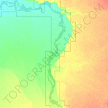
Name: Alagnak River topographic map, elevation, terrain.

Location: Alagnak River, Lake and Peninsula, Alaska, United States (59.04474 -156.38777 59.12380 -156.27819)

Average elevation: 128 ft

Minimum elevation: 56 ft

Maximum elevation: 210 ft

Lake and Peninsula trails, hiking, mountain biking, running and outdoor activities

Other topographic maps

Click on a map to view its topography, its elevation and its terrain.

Newhalen

United States > Alaska > Lake and Peninsula > Newhalen

Average elevation: 75 ft

Nondalton

United States > Alaska > Lake and Peninsula > Nondalton

Average elevation: 387 ft

Cinder Cone

United States > Alaska > Lake and Peninsula

Average elevation: 6,047 ft

Sharp Mountain

United States > Alaska > Lake and Peninsula

Average elevation: 1,332 ft

Levelock

United States > Alaska > Lake and Peninsula

Average elevation: 59 ft

Iliamna

United States > Alaska > Lake and Peninsula

Average elevation: 69 ft

Igiugig

United States > Alaska > Lake and Peninsula

Average elevation: 95 ft

Gear up for your next adventure:

📷Action Cameras - Rugged cameras to document your journeys across rugged terrain
🏕️Tent Footprint - Protect your tent base from wear
💧Water Purification System - Clean water on the trail with reliable purifiers
🎒Gear Packing Cubes - Organize your backpack efficiently
🌡️Portable Weather Meter - Track weather conditions on the trail

As an Amazon Associate, this site earns from qualifying purchases at no extra cost to you.