Geolocate

Levelock topographic map

Click on the map to display elevation.

About this map

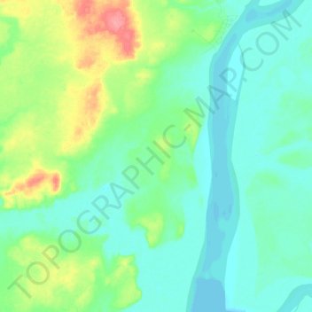
Name: Levelock topographic map, elevation, terrain.

Location: Levelock, Lake and Peninsula, Alaska, 99625, United States (59.00514 -156.94832 59.12286 -156.84447)

Average elevation: 59 ft

Minimum elevation: 0 ft

Maximum elevation: 243 ft

Lake and Peninsula trails, hiking, mountain biking, running and outdoor activities

Other topographic maps

Click on a map to view its topography, its elevation and its terrain.

Newhalen

United States > Alaska > Lake and Peninsula > Newhalen

Average elevation: 75 ft

Nondalton

United States > Alaska > Lake and Peninsula > Nondalton

Average elevation: 387 ft

Chignik

United States > Alaska > Lake and Peninsula

Average elevation: 463 ft

Egegik

United States > Alaska > Lake and Peninsula

Average elevation: 33 ft

Pilot Point

United States > Alaska > Lake and Peninsula

Average elevation: 20 ft

Port Heiden

United States > Alaska > Lake and Peninsula

Average elevation: 75 ft

Sharp Mountain

United States > Alaska > Lake and Peninsula

Average elevation: 1,332 ft

Cinder Cone

United States > Alaska > Lake and Peninsula

Average elevation: 6,047 ft

Alagnak River

United States > Alaska > Lake and Peninsula

Average elevation: 128 ft

Ugashik

United States > Alaska > Lake and Peninsula

Average elevation: 121 ft

Iliamna

United States > Alaska > Lake and Peninsula

Average elevation: 69 ft

Aniakchak National Monument

United States > Alaska > Lake and Peninsula

The national monument is centered on the 6-mile (9.7 km) diameter crater of ancient Mount Aniakchak, which was destroyed and the resulting crater formed during a caldera collapse event about 3,700 years ago. The original mountain, about 7,000 feet (2,100 m) tall, collapsed into its magma chamber, leaving an…

Average elevation: 1,234 ft

Gear up for your next adventure:

🌄Hiking Binoculars - Compact binoculars for scenic views and trail spotting
🛠️Outdoor Gear Repair Kit - Essential tools to fix gear on the trail
🔭Compact Binoculars - HD vision for scouting terrain and identifying distant landmarks
🏫Relief Map Kits - Hands-on tools for teaching landforms and elevation
🌎3D Topographic Globes - Raised relief globes for a tactile understanding of geography

As an Amazon Associate, this site earns from qualifying purchases at no extra cost to you.