
扯旗山 topographic map
Interactive map
Click on the map to display elevation.
About this map
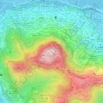
Name: 扯旗山 topographic map, elevation, terrain.
Location: 扯旗山, 香港島, 中西區, 香港, 中国 (22.27599 114.14541 22.27609 114.14551)
Average elevation: 686 ft
Minimum elevation: -7 ft
Maximum elevation: 1,752 ft
Other topographic maps
Click on a map to view its topography, its elevation and its terrain.