Geolocate

Wadi Sebua topographic map

Click on the map to display elevation.

About this map

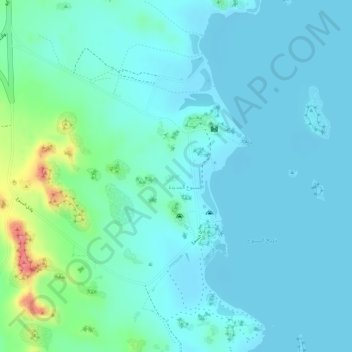
Name: Wadi Sebua topographic map, elevation, terrain.

Location: Wadi Sebua, Aswan, Egypt (22.78819 32.54043 22.80615 32.54828)

Average elevation: 633 ft

Minimum elevation: 581 ft

Maximum elevation: 863 ft

Other topographic maps

Click on a map to view its topography, its elevation and its terrain.

Syena

Egypt > Aswan

Average elevation: 374 ft

Al Sharauna

Egypt > Aswan > Al Sharauna

Average elevation: 302 ft

Gear up for your next adventure:

🔪Outdoor Multitools - Essential survival tools for gear repair and field use
📡GPS Antenna Upgrade - Enhance GPS reception in remote terrain
🚁Photography Drones - Capture stunning aerial views of landforms and topography
👓Polarized Sunglasses - Outdoor sunglasses for glare reduction
⛑️Personal Locator Beacon - Safety beacon for emergencies

As an Amazon Associate, this site earns from qualifying purchases at no extra cost to you.