
Cloverdale topographic map
Click on the map to display elevation.
About this map
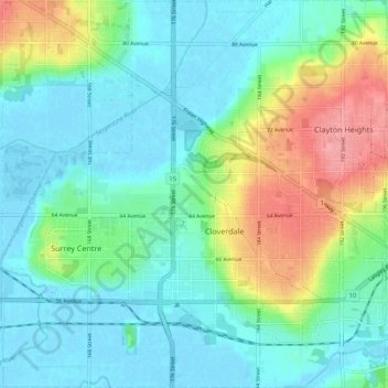
Name: Cloverdale topographic map, elevation, terrain.
Average elevation: 79 ft
Minimum elevation: -10 ft
Maximum elevation: 285 ft
Other topographic maps
Click on a map to view its topography, its elevation and its terrain.
Surrey
Canada > British Columbia > Metro Vancouver Regional District > Surrey
Average elevation: 213 ft
Cottonwood Park
Canada > British Columbia > Metro Vancouver Regional District > Surrey
Average elevation: 121 ft
Newton Athletic Park
Canada > British Columbia > Metro Vancouver Regional District > Surrey
Average elevation: 282 ft
Walnut Park
Canada > British Columbia > Metro Vancouver Regional District > Surrey
Average elevation: 161 ft
Morgan Heights
Canada > British Columbia > Metro Vancouver Regional District > Surrey
Average elevation: 200 ft
Tynehead Regional Park
Canada > British Columbia > Metro Vancouver Regional District > Surrey
Average elevation: 148 ft
Crescent Beach
Canada > British Columbia > Metro Vancouver Regional District > Surrey
Average elevation: 72 ft
Green Timbers Urban Forest
Canada > British Columbia > Metro Vancouver Regional District > Surrey
Average elevation: 328 ft
Panorama Park Off-Leash Area
Canada > British Columbia > Metro Vancouver Regional District > Surrey
Average elevation: 249 ft
Cresent Rock Beach
Canada > British Columbia > Metro Vancouver Regional District > Surrey
Average elevation: 95 ft
Tynehead Regional Park
Canada > British Columbia > Metro Vancouver Regional District > Surrey
Average elevation: 148 ft
Cougar Creek Park
Canada > British Columbia > Metro Vancouver Regional District > Surrey
Average elevation: 282 ft