Barriac topographic map
Click on the map to display elevation.
About this map
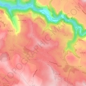
Name: Barriac topographic map, elevation, terrain.
Average elevation: 1,759 ft
Minimum elevation: 1,204 ft
Maximum elevation: 2,001 ft
Other topographic maps
Click on a map to view its topography, its elevation and its terrain.
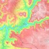
Millau
Le territoire de cette commune matérialise une fraction sud du Massif central. De grande superficie (16 823 hectares, 25e commune de France métropolitaine la plus étendue), le territoire communal s'étend au cœur des Grands Causses, sur une partie du causse Rouge (à l'est du plateau du Lévézou), une…
Average elevation: 2,152 ft

Salles-Curan
L'altitude minimale, 547 mètres, se trouve localisée à l'extrême sud, près du lieu-dit le Puech de Coudols, là où le ruisseau d'Ourtiguet — sous-affluent du Tarn — quitte la commune et sert de limite entre celles d'Ayssènes et de Viala-du-Tarn. L'altitude maximale avec 1 084 mètres se situe à…
Average elevation: 2,835 ft
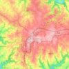
Baraqueville
Avant 1810 : Rien, ou presque. De l'époque romaine, on retient la fontaine de Vors (709 m d'altitude) qui alimente Rodez en eau par un ingénieux système d'aqueduc de 30 km de longueur, souterrain d'abord, aérien ensuite. À vol d'oiseau, la distance n'est que de 12 km. En fait, l'aqueduc est très sinueux,…
Average elevation: 2,221 ft

Le Vibal
Le Viaur prend sa source à 1 086 m d’altitude dans la région naturelle du Lévézou qui présente un relief vallonné, dans la commune de Vézins-de-Lévézou pour confluer, après avoir parcouru environ 168 km, avec l'Aveyron à 146 m d’altitude en limite de Laguépie (Tarn-et-Garonne) et…
Average elevation: 2,631 ft
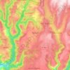
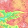

Ségur
Le Viaur prend sa source à 1 086 m d’altitude dans la région naturelle du Lévézou qui présente un relief vallonné, dans la commune de Vézins-de-Lévézou pour confluer, après avoir parcouru environ 168 km, avec l'Aveyron à 146 m d’altitude en limite de Laguépie (Tarn-et-Garonne) et…
Average elevation: 2,844 ft
Canet-de-Salars
Plusieurs études ont été menées afin de caractériser les types climatiques auxquels est exposé le territoire national. Les zonages obtenus diffèrent selon les méthodes utilisées, la nature et le nombre des paramètres pris en compte, le maillage territorial des données et la période de référence.…
Average elevation: 2,687 ft

Lac de Pareloup
France > Occitanie > Aveyron > Canet-de-Salars
Le lac de Pareloup ou retenue de Pareloup se trouve dans l'Aveyron, entre Rodez et Millau sur le plateau du Lévézou à 805 m d'altitude.
Average elevation: 2,717 ft

Rivière-sur-Tarn
L'altitude minimale, 372 mètres, se trouve localisée à l'extrême sud, là où le Tarn quitte la commune et sert de limite entre celles de Compeyre et La Cresse. L'altitude maximale avec 871 ou 880 mètres est située trois kilomètres au nord-ouest du bourg, au puech de Suège.
Average elevation: 2,073 ft
Flavin
Le Viaur prend sa source à 1 086 m d’altitude dans la région naturelle du Lévézou qui présente un relief vallonné, dans la commune de Vézins-de-Lévézou pour confluer, après avoir parcouru environ 168 km, avec l'Aveyron à 146 m d’altitude en limite de Laguépie (Tarn-et-Garonne) et…
Average elevation: 2,201 ft
Sévérac-le-Château
France > Occitanie > Aveyron > Sévérac d'Aveyron
La butte de Sévérac, qui culmine à 817 m d'altitude, a été occupée dès la préhistoire. En témoignent les dolmens que l'on trouve sur la route des dolmens en direction du village de Buzeins.
Average elevation: 2,674 ft


Rodez
Le climat de Rodez fait partie de l'étage supra-méditerranéen. Sous l'influence d'un climat semi-continental en hiver, et méditerranéen en été, Rodez reste une ville froide par rapport aux autres villes du midi de la France. Les hivers y sont vifs tout comme les étés souvent très chauds et…
Average elevation: 1,860 ft
Saint-Affrique
La superficie de la commune est de 11 096 hectares ; son altitude varie de 279 à 720 mètres.
Average elevation: 1,690 ft
Decazeville
La commune de Decazeville se trouve dans la vallée d'un ruisseau affluent du Lot appelé le Riou Mort (exactement: lo Riu Mòrt, forme occitane signifiant « ruisseau mort »), à environ 200 m d’altitude.
Average elevation: 935 ft
Saint-Geniez-d'Olt
France > Occitanie > Aveyron > Saint-Geniez d'Olt et d'Aubrac
Average elevation: 2,014 ft
Arvieu
L'altitude minimale, 606 mètres, se trouve localisée à l'extrême ouest, près du lieu-dit le Puech d'Espinous, là où le ruisseau du Lagast — affluent du Céor — quitte la commune et entre sur celle de Salmiech. L'altitude maximale avec 929 mètres se situe au sud-est, au réservoir d’eau de Bonneviale.
Average elevation: 2,595 ft
Entraygues-sur-Truyère
L'altitude minimale, 222 mètres, se trouve localisée à l'ouest, là où le Lot quitte la commune et sert de limite entre celles d'Espeyrac et du Fel. L'altitude maximale avec 744 ou 759 mètres est située dans l'est, au nord du lieu-dit Albrespic.
Average elevation: 1,581 ft
La Cavalerie
L'altitude minimale, avec 763 ou 764 mètres, se trouve localisée dans le sud-est, à l'intérieur de la carrière « Le Cavet ». L'altitude maximale avec 892 mètres est située dans le nord-est, près du lieu-dit Lestournel.
Average elevation: 2,579 ft

Villefranche-de-Panat
L'altitude minimale, avec 260 mètres, se trouve localisée à l'extrême sud-ouest, près du lieu-dit Rieugros, là où le Tarn quitte la commune et entre dans celle de Broquiès. L'altitude maximale avec 984 mètres est située à l'extrême nord, sur le Lévézou, au lieu-dit Lavinal.
Average elevation: 2,326 ft

Naucelle
Naucelle est une commune située dans l'ouest du département de l'Aveyron, à mi-distance environ de Rodez et d'Albi, respectivement préfecture de l'Aveyron et préfecture du Tarn. Peuplée de 2 000 habitants environ, elle est située à 500 mètres d'altitude, au cœur du Ségala, dans le sud-ouest du Massif central.
Average elevation: 1,555 ft
Estaing
L'altitude minimale, 301 mètres, se trouve à l'ouest, dans la retenue du barrage de Golinhac, là où le Lot quitte la commune et sert de limite entre celles de Golinhac et du Nayrac. L'altitude maximale avec 760 mètres est localisée à l'extrême nord, près du lieu-dit les Prats, en limite de la commune du Nayrac.
Average elevation: 1,736 ft

Vézins-de-Lévézou
L'altitude minimale, 713 mètres, se trouve localisée à l'extrême est, là où le ruisseau de Destels — un affluent du Lumansonesque — quitte la commune et sert de limite entre celles de Sévérac d'Aveyron et de Verrières. L'altitude maximale se situe également à l'est, au puech du Pal avec 1 155 mètres.
Average elevation: 2,877 ft
Prades-d'Aubrac
Le Lot prend sa source à 1272 m d’altitude sur la montagne du Goulet (nord du Mont Lozère), dans la commune de Cubières (48), et se jette dans la Garonne à Aiguillon (47), après avoir parcouru 484 km et traversé 129 communes.
Average elevation: 2,743 ft

Clairvaux-d'Aveyron
C'est au fond de la vallée de l'Ady que se situent les villages de Clairvaux et de Bruéjouls qui regroupent l'essentiel de la population. À l'Est, sur une hauteur en bordure du Causse comtal, le petit village de Panat est groupé au pied de son château. À l'Ouest, la chapelle Notre-Dame du Buenne, à 736…
Average elevation: 1,765 ft

Curières
Plusieurs études ont été menées afin de caractériser les types climatiques auxquels est exposé le territoire national. Les zonages obtenus diffèrent selon les méthodes utilisées, la nature et le nombre des paramètres pris en compte, le maillage territorial des données et la période de référence.…
Average elevation: 3,274 ft
Cassagnes-Bégonhès
Le Viaur prend sa source à 1200 m d’altitude dans la région naturelle du Lévézou qui présente un relief vallonné, dans la commune de Vézins-de-Lévézou pour confluer, après avoir parcouru environ 168 km, avec l'Aveyron à 400 m d’altitude à Lacroix-Barrez, après avoir arrosé 30 communes.
Average elevation: 1,952 ft


Cantoin
Le lac de Sarrans est un lac de retenue lié au barrage de Sarrans. Situé à 647 m d'altitude, son volume s'élève à 296 millions de mètres cubes d'eau. Le lac arrose plusieurs communes auxquelles il sert de limite naturelle, dont quatre en Aveyron : Brommat, Cantoin, Sainte-Geneviève-sur-Argence et Thérondels.
Average elevation: 2,841 ft
Peyreleau
L'altitude minimale, avec 379 ou 392 mètres se trouve localisée à l'extrême nord-ouest, là où le Tarn quitte la commune et entre sur celle de Mostuéjouls. L'altitude maximale avec 882 mètres est située à l'est, à la Croix de Montfraysse.
Average elevation: 2,346 ft

Pont-de-Salars
Le Viaur prend sa source à 1200 m d’altitude dans la région naturelle du Lévézou qui présente un relief vallonné, dans la commune de Vézins-de-Lévézou pour confluer, après avoir parcouru environ 168 km, avec l'Aveyron à 400 m d’altitude à Lacroix-Barrez, après avoir arrosé 30 communes.
Average elevation: 2,572 ft
Mostuéjouls
L'altitude minimale, 376 mètres, se trouve localisée à l'extrême sud-ouest, là où le Tarn quitte la commune et entre sur celle de Rivière-sur-Tarn. L'altitude maximale avec 961 ou 962 mètres est située au nord-est, au lieu-dit la Barre.
Average elevation: 2,352 ft
Saint-Chély-d'Aubrac
Saint-Chély-d'Aubrac et Aubrac sont les deux étapes aveyronnaises de l'Aubrac qui mènent à la vallée du Lot. On quitte Aubrac à 1 300 mètres d'altitude et, en 7 kilomètres, on arrive à Saint-Chély-d'Aubrac à 800 mètres d'altitude, puis on sort de l'Aubrac par Saint-Côme-d'Olt à 400 mètres…
Average elevation: 3,251 ft
Argences en Aubrac
Le lac de Sarrans est un lac de retenue lié au barrage de Sarrans. Situé à 647 m d'altitude, son volume s'élève à 296 millions de mètres cubes d'eau. Le lac arrose plusieurs communes auxquelles il sert de limite naturelle, dont quatre en Aveyron : Brommat, Cantoin, Sainte-Geneviève-sur-Argence et Thérondels.
Average elevation: 3,045 ft
Sainte-Radegonde
S'étendant sur 2 965 hectares, la commune de Sainte-Radegonde présente une grande variété de paysages. Au Nord, elle couvre une partie de la plaine alluviale de l'Aveyron, l'altitude moyenne y est de 535 m.
Average elevation: 2,073 ft
Saint-Félix-de-Sorgues
Saint-Félix-de-Sorgues fait partie du canton de Saint-Affrique et compte environ 200 habitants répartis en dix fermes et un village situés à 416 mètres d'altitude dans la vallée de la Sorgues, entre Roquefort et Sylvanès.
Average elevation: 1,909 ft
Camjac
Le Viaur prend sa source à 1 086 m d’altitude dans la région naturelle du Lévézou qui présente un relief vallonné, dans la commune de Vézins-de-Lévézou pour confluer, après avoir parcouru environ 168 km, avec l'Aveyron à 146 m d’altitude en limite de Laguépie (Tarn-et-Garonne) et…
Average elevation: 1,581 ft
Salles-la-Source
Pour les deux tiers de sa superficie, Salles-la-Source occupe la pointe ouest du causse Comtal, plateau calcaire dans le prolongement des Grands Causses. La faille sud du causse Comtal, où la rivière du Créneau a creusé sa vallée, sépare la commune en deux. Son altitude moyenne est de 408 mètres, son…
Average elevation: 1,703 ft

Sauveterre-de-Rouergue
Ancienne bastide royale située à 30 km de Rodez sur le tracé de la Méridienne Verte qui passe à quelques centaines de mètres du bourg (la commune a été associée à cette opération de l’an 2000), Sauveterre-de-Rouergue se situe sur les derniers contreforts du Massif central, à 466 mètres…
Average elevation: 1,768 ft



Bor-et-Bar
Le Viaur prend sa source à 1 086 m d’altitude dans la région naturelle du Lévézou qui présente un relief vallonné, dans la commune de Vézins-de-Lévézou pour confluer, après avoir parcouru environ 168 km, avec l'Aveyron à 146 m d’altitude en limite de Laguépie (Tarn-et-Garonne) et…
Average elevation: 1,237 ft

La Salvetat-Peyralès
Le Viaur prend sa source à 1200 m d’altitude dans la région naturelle du Lévézou qui présente un relief vallonné, dans la commune de Vézins-de-Lévézou pour confluer, après avoir parcouru environ 168 km, avec l'Aveyron à 400 m d’altitude à Lacroix-Barrez, après avoir arrosé 30 communes.
Average elevation: 1,581 ft

Calmont
Le Viaur prend sa source à 1 086 m d’altitude dans la région naturelle du Lévézou qui présente un relief vallonné, dans la commune de Vézins-de-Lévézou pour confluer, après avoir parcouru environ 168 km, avec l'Aveyron à 146 m d’altitude en limite de Laguépie (Tarn-et-Garonne) et…
Average elevation: 2,198 ft

Tauriac-de-Naucelle
Le Viaur prend sa source à 1 086 m d’altitude dans la région naturelle du Lévézou qui présente un relief vallonné, dans la commune de Vézins-de-Lévézou pour confluer, après avoir parcouru environ 168 km, avec l'Aveyron à 146 m d’altitude en limite de Laguépie (Tarn-et-Garonne) et…
Average elevation: 1,434 ft

Saint-Laurent-de-Lévézou
L'altitude minimale, 614 mètres, se trouve localisée à l'extrême sud-est, en amont du gué de Salsac, là où la Muze quitte la commune et entre sur celle de Saint-Beauzély. L'altitude maximale se situe au mont Seigne avec 1 121 ou 1 128 m.
Average elevation: 2,815 ft



Brasc
L'altitude minimale, 214 mètres, se trouve localisée à l'extrême sud-ouest, là où le Tarn quitte la commune et sert de limite entre celles de Fraissines et de La Bastide-Solages. L'altitude maximale avec 658 mètres se situe à l'est, près des lieux-dits la Molière, les Rosiers et la Vergnière.
Average elevation: 1,535 ft

Salmiech
L'altitude minimale, 517 mètres, se trouve localisée à l'extrême nord-ouest, près du lieu-dit la Griffoulière, là où le ruisseau de Violelle — un autre affluent du Viaur — quitte la commune et sert de limite entre celles de Cassagnes-Bégonhès et de Comps-la-Grand-Ville. L'altitude maximale avec…
Average elevation: 2,126 ft



Vabres-l'Abbaye
Vabres-l'Abbaye est située dans la partie sud du Massif central à 300 mètres d'altitude. Elle est située en banlieue de l'agglomération urbaine de Saint-Affrique.
Average elevation: 1,430 ft
Sainte-Eulalie-d'Olt
L'altitude minimale, 407 mètres, se trouve au nord-ouest, là où le Lot quitte la commune et sert de limite à celles de Castelnau-de-Mandailles et Lassouts. L'altitude maximale avec 876 mètres est également localisée au nord-ouest, au Puy de Campèch.
Average elevation: 1,808 ft
Lescure-Jaoul
Le Viaur prend sa source à 1 086 m d’altitude dans la région naturelle du Lévézou qui présente un relief vallonné, dans la commune de Vézins-de-Lévézou pour confluer, après avoir parcouru environ 168 km, avec l'Aveyron à 146 m d’altitude en limite de Laguépie (Tarn-et-Garonne) et…
Average elevation: 1,535 ft
Florentin-la-Capelle
L'altitude minimale, 230 mètres, se trouve à l'extrême ouest, là où le Lot quitte la commune et entre sur celle d'Entraygues-sur-Truyère. L'altitude maximale avec 803 mètres est localisée au sud-est, près du lieu-dit leThomas.
Average elevation: 2,064 ft

Saint-Victor-et-Melvieu
L'altitude minimale, avec 262 mètres, se trouve localisée à l'extrême ouest, près du lieu-dit le Mas d'Entraygues, là où le Tarn quitte la commune et entre dans celle du Truel. L'altitude maximale avec 689 ou 694 mètres est située un kilomètre et demi au nord-ouest du bourg de Saint-Victor, au puech…
Average elevation: 1,624 ft

Salvagnac-Cajarc
Le Lot prend sa source à 1272 m d’altitude sur la montagne du Goulet (nord du Mont Lozère), dans la commune de Cubières (48), et se jette dans la Garonne à Monheurt (47), après avoir parcouru 484 km et traversé 129 communes.
Average elevation: 863 ft

Causse-et-Diège
Le Lot prend sa source à 1 272 m d'altitude sur la montagne du Goulet (nord du Mont Lozère), dans la commune de Cubières (48), et se jette dans la Garonne à Monheurt (47), après avoir parcouru 484 km et traversé 129 communes.
Average elevation: 1,024 ft

Lassouts
L'altitude minimale, 360 mètres, se trouve à l'extrême-nord, là où le Lot quitte la commune et sert de limite entre celles de Castelnau-de-Mandailles et Saint-Côme-d'Olt. L'altitude maximale avec 863 mètres est localisée à l'est, sur les pentes du Puy de Campèch, en limite de la commune de Sainte-Eulalie-d'Olt.
Average elevation: 1,906 ft