
Make a donation
Gear up for your next adventure:
As an Amazon Associate, this site earns from qualifying purchases at no extra cost to you.
Ala-Köl topographic map
Click on the map to display elevation.
Make a donation
Gear up for your next adventure:
As an Amazon Associate, this site earns from qualifying purchases at no extra cost to you.
Ala-Köl
Ala-Köl (Kyrgyz: Ала-Көл, also Алакөл, Russian: Ала-Куль, romanized: Ala-Kul) is a rock-dammed lake in the Terskey Alatau mountain range in the Ak-Suu District of the Issyk-Kul Region in Kyrgyzstan. It lies at an altitude of 3,532 m (11,588 ft). It is 2.8 km (1.7 mi) long and 600–700 m (2,000–2,300 ft) wide. Its area is 1.5 km2 (0.58 sq mi).
Make a donation
Gear up for your next adventure:
As an Amazon Associate, this site earns from qualifying purchases at no extra cost to you.
About this map
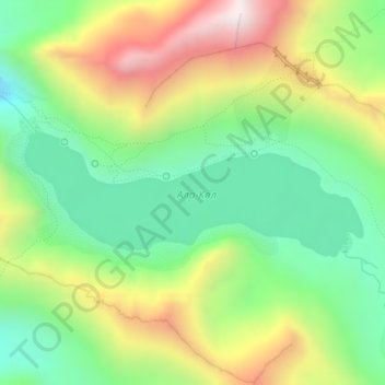
Name: Ala-Köl topographic map, elevation, terrain.
Location: Ala-Köl, Ak-Suu District, Issyk-Kul Region, Kyrgyzstan (42.31334 78.51930 42.32210 78.55159)
Average elevation: 12,149 ft
Minimum elevation: 11,070 ft
Maximum elevation: 13,793 ft
Make a donation
Gear up for your next adventure:
As an Amazon Associate, this site earns from qualifying purchases at no extra cost to you.
Other topographic maps
Click on a map to view its topography, its elevation and its terrain.
Jengish Chokusu
Kyrgyzstan > Issyk-Kul Region > Ak-Suu District
Jengish Chokusu or Victory Peak is the highest mountain in the Tian Shan mountain system in Central Asia at 7,439 metres (24,406 ft). It lies on the China–Kyrgyzstan border between the Ak-Suu District in the Issyk-Kul Region of far Eastern Kyrgyzstan and Wensu County, Xinjiang, China. It is part of the…
Average elevation: 21,919 ft
Make a donation
Gear up for your next adventure:
As an Amazon Associate, this site earns from qualifying purchases at no extra cost to you.
Khan Tengri
Kyrgyzstan > Issyk-Kul Region > Ak-Suu District
Khan Tengri is a mountain of the Tian Shan mountain range in Central Asia. It is on the China—Kyrgyzstan—Kazakhstan tripoint, east of lake Issyk Kul. Its geologic elevation is 6,995 m (22,949 ft), but its glacial icecap rises to 7,010 m (22,999 ft). For this reason, in mountaineering circles, including for…
Average elevation: 19,337 ft
Jengish Chokusu
Kyrgyzstan > Issyk-Kul Region > Ak-Suu District
Jengish Chokusu is the highest mountain in Kyrgyzstan and Earth's highest mountain north of 39°N. It is considered the most northerly 7,000-metre mountain in the world by geologists; the actual rock summit of Khan Tengri, the Tian Shan's second-highest peak, is 6,995m above sea level, though a thick layer of…
Average elevation: 21,864 ft